Geolocate

Sekinchan topographic map

Click on the map to display elevation.

About this map

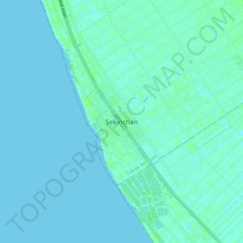
Name: Sekinchan topographic map, elevation, terrain.

Location: Sekinchan, Sabak Bernam, Selangor, 45400, Malaysia (3.46643 101.06268 3.54643 101.14268)

Average elevation: 7 ft

Minimum elevation: -3 ft

Maximum elevation: 30 ft

Other topographic maps

Click on a map to view its topography, its elevation and its terrain.

Langat River

Malaysia > Selangor

Average elevation: 351 ft

Section 36

Malaysia > Selangor > Shah Alam

Average elevation: 26 ft

Sunway Utama

Malaysia > Selangor > Subang Jaya

Average elevation: 62 ft

Langat River (bypass)

Malaysia > Selangor

Average elevation: 16 ft

Klang

Malaysia > Selangor

Average elevation: 36 ft

Cyberjaya

Malaysia > Selangor > Sepang

Average elevation: 79 ft

SS7, Petaling Jaya

Malaysia > Selangor > Petaling Jaya

Average elevation: 108 ft

Hulu Langat

Malaysia > Selangor

Average elevation: 784 ft

Petaling

Malaysia > Selangor

Average elevation: 144 ft

Sungai Inki

Malaysia > Selangor > Kalumpang

Average elevation: 266 ft

Sungai Air Hitam

Malaysia > Selangor > Sepang

Average elevation: 10 ft

Sungai Kuyoh

Malaysia > Selangor > Subang Jaya

Average elevation: 197 ft

Kuala Langat

Malaysia > Selangor

Average elevation: 20 ft

Ulu Tamu Hot Spring

Malaysia > Selangor

Average elevation: 312 ft

Gear up for your next adventure:

🎒Trekking Poles - Sturdy poles for balance and stability on rough terrain
🧦Hiking Socks - Comfortable socks to prevent blisters on long hikes
🧭Pro Hiking Compasses - High-accuracy liquid-filled compasses for topographic orientation
🥇GPS Hiking Watch - Multi‑sport GPS watch with navigation and trail tracking
🧦Merino Wool Socks - Moisture-wicking, blister-preventing socks for long treks

As an Amazon Associate, this site earns from qualifying purchases at no extra cost to you.