Geolocate

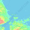
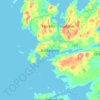
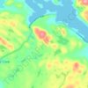
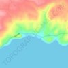
Burlington topographic map

Click on the map to display elevation.

About this map

Name: Burlington topographic map, elevation, terrain.

Location: Burlington, Newfoundland, Newfoundland and Labrador, Canada (49.73449 -56.03270 49.76025 -55.99190)

Average elevation: 92 ft

Minimum elevation: -7 ft

Maximum elevation: 719 ft

Other topographic maps

Click on a map to view its topography, its elevation and its terrain.
Bell Island

Canada > Newfoundland and Labrador

Average elevation: 30 ft

Labrador

Canada > Newfoundland and Labrador

Average elevation: 2,211 ft

Englee

Canada > Newfoundland and Labrador > Englee

Average elevation: 112 ft

Mount Caubvick

Canada > Newfoundland and Labrador

Average elevation: 4,173 ft

Highway 220

Canada > Newfoundland and Labrador

Average elevation: 26 ft

Whitbourne

Canada > Newfoundland and Labrador > Whitbourne

Average elevation: 230 ft

Grosse Point

Canada > Newfoundland and Labrador

Average elevation: 82 ft
Ragged Point

Canada > Newfoundland and Labrador

Average elevation: 20 ft

Bridgeport

Canada > Newfoundland and Labrador

Average elevation: 72 ft

Monroe

Canada > Newfoundland and Labrador

Average elevation: 135 ft

Smokey

Canada > Newfoundland and Labrador > Smokey

Average elevation: 46 ft

Tims Hill

Canada > Newfoundland and Labrador

Average elevation: 413 ft

Gear up for your next adventure:

🏕️Tent Footprint - Protect your tent base from wear
⌚GPS Sports Watch - GPS watch for running, hiking and training
🔌Solar Panel Charger - Charge gear sustainably outdoors
🧭GPS Watch Accessories - Bands and chargers for GPS watches
☀️Outdoor Sunscreen - High protection sunscreen for outdoor activities

As an Amazon Associate, this site earns from qualifying purchases at no extra cost to you.