Geolocate

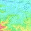
Brenchley topographic map

Click on the map to display elevation.

About this map

Name: Brenchley topographic map, elevation, terrain.

Location: Brenchley, Tunbridge Wells, Kent, England, TN12 7NJ, United Kingdom (51.13085 0.37988 51.17085 0.41988)

Average elevation: 223 ft

Minimum elevation: 56 ft

Maximum elevation: 436 ft

Other topographic maps

Click on a map to view its topography, its elevation and its terrain.
Frittenden

United Kingdom > England > Kent > Tunbridge Wells

Average elevation: 112 ft

Hawkhurst

United Kingdom > England > Kent > Tunbridge Wells

Average elevation: 220 ft

Paddock Wood

United Kingdom > England > Kent > Tunbridge Wells

Average elevation: 108 ft

Goudhurst

United Kingdom > England > Kent > Tunbridge Wells > Goudhurst

Average elevation: 249 ft

Benenden

United Kingdom > England > Kent > Tunbridge Wells

Average elevation: 200 ft

Pembury

United Kingdom > England > Kent > Tunbridge Wells

Average elevation: 325 ft

Bidborough

United Kingdom > England > Kent > Tunbridge Wells

Average elevation: 233 ft

Horsmonden

United Kingdom > England > Kent > Tunbridge Wells > Horsmonden

Average elevation: 167 ft

Speldhurst

United Kingdom > England > Kent > Tunbridge Wells

Average elevation: 292 ft

Rusthall

United Kingdom > England > Kent > Tunbridge Wells > Rusthall

Average elevation: 328 ft

Capel

United Kingdom > England > Kent > Tunbridge Wells

Average elevation: 154 ft

Hurst Wood

United Kingdom > England > Kent > Tunbridge Wells > Rusthall

Average elevation: 331 ft

Lamberhurst

United Kingdom > England > Kent > Tunbridge Wells > Lamberhurst

Average elevation: 276 ft

Benenden

United Kingdom > England > Kent > Tunbridge Wells > Benenden

Average elevation: 200 ft

Hawkhurst

United Kingdom > England > Kent > Tunbridge Wells

Average elevation: 220 ft

Benenden

United Kingdom > England > Kent > Tunbridge Wells

Average elevation: 200 ft

Goudhurst

United Kingdom > England > Kent > Tunbridge Wells

Average elevation: 249 ft

Paddock Wood

United Kingdom > England > Kent > Tunbridge Wells > Whetsted

Average elevation: 108 ft

Capel

United Kingdom > England > Kent > Tunbridge Wells

Average elevation: 154 ft

Gear up for your next adventure:

🌡️Portable Weather Meter - Track weather conditions on the trail
🔪Outdoor Multitools - Essential survival tools for gear repair and field use
🧷Carabiner Set - Durable clips for gear attachment
🌎3D Topographic Globes - Raised relief globes for a tactile understanding of geography
🔭Compact Binoculars - HD vision for scouting terrain and identifying distant landmarks

As an Amazon Associate, this site earns from qualifying purchases at no extra cost to you.