
Hopton Castle topographic map
Click on the map to display elevation.
About this map
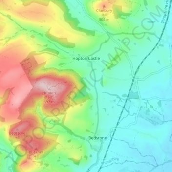
Name: Hopton Castle topographic map, elevation, terrain.
Location: Hopton Castle, Shropshire, England, United Kingdom (52.37234 -2.98435 52.40696 -2.90526)
Average elevation: 676 ft
Minimum elevation: 390 ft
Maximum elevation: 1,253 ft
Other topographic maps
Click on a map to view its topography, its elevation and its terrain.
Minton
United Kingdom > England > Shropshire > Church Stretton > Little Stretton
Average elevation: 892 ft
Cothercott Hill
United Kingdom > England > Shropshire > Church Pulverbatch
Average elevation: 1,122 ft