
Magpet topographic map
Click on the map to display elevation.
Magpet
Rice production in Magpet is only 1.16% or 1,028 hectares of the total land area with another 1.50% or 1,115 hectares as potential area due to its land topography, which is mostly hilly or mountainous.
About this map
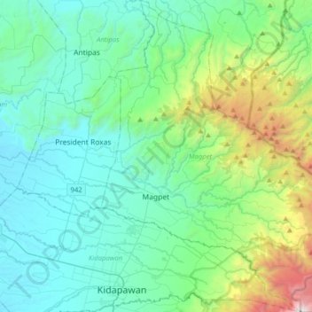
Name: Magpet topographic map, elevation, terrain.
Location: Magpet, North Cotabato, Soccsksargen, 9404, Philippines (6.98734 125.06948 7.29940 125.31449)
Average elevation: 1,959 ft
Minimum elevation: 190 ft
Maximum elevation: 9,593 ft
Other topographic maps
Click on a map to view its topography, its elevation and its terrain.