
青岗坡 topographic map
Interactive map
Click on the map to display elevation.
About this map
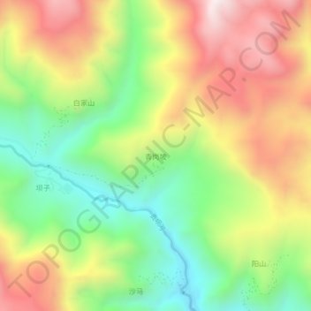
Name: 青岗坡 topographic map, elevation, terrain.
Location: 青岗坡, 舟曲县, 甘南藏族自治州, 甘肃省, 746300, 中国 (33.60750 104.26826 33.64750 104.30826)
Average elevation: 7,579 ft
Minimum elevation: 6,191 ft
Maximum elevation: 9,213 ft
Other topographic maps
Click on a map to view its topography, its elevation and its terrain.