
立节镇 topographic map
Interactive map
Click on the map to display elevation.
About this map
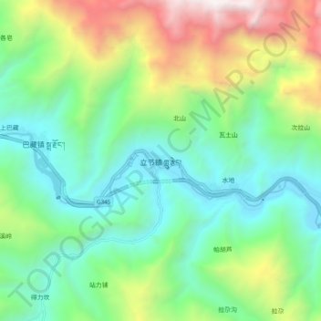
Name: 立节镇 topographic map, elevation, terrain.
Location: 立节镇, 舟曲县, 甘南藏族自治州, 甘肃省, 746300, 中国 (33.85733 104.02800 33.93733 104.10800)
Average elevation: 7,326 ft
Minimum elevation: 4,984 ft
Maximum elevation: 12,641 ft
Other topographic maps
Click on a map to view its topography, its elevation and its terrain.