Geolocate

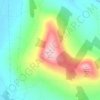
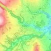
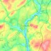
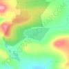
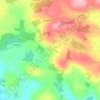
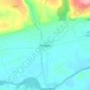
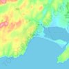
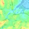
Monfin topographic map

Click on the map to display elevation.

About this map

Name: Monfin topographic map, elevation, terrain.

Location: Monfin, Enniscorthy Rural, The Municipal District of Enniscorthy, County Wexford, Leinster, Ireland (52.47366 -6.59142 52.48702 -6.57454)

Average elevation: 102 ft

Minimum elevation: -3 ft

Maximum elevation: 210 ft

Other topographic maps

Click on a map to view its topography, its elevation and its terrain.
Cork

Ireland > County Cork > Cork

Average elevation: 308 ft

Galway City

Ireland > Galway City

Average elevation: 85 ft

Millstreet

Ireland > County Cork > Millstreet

Average elevation: 558 ft

Athlone

Ireland > County Westmeath > Athlone

Average elevation: 144 ft

River Shannon

Ireland

Average elevation: 128 ft

Cromane

Ireland

Average elevation: 10 ft

Maghera Strand

Ireland

Average elevation: 121 ft

Knockdrin

Ireland

Average elevation: 315 ft

Ballycurry

Ireland

Average elevation: 584 ft

Ballyedmond

Ireland

Average elevation: 240 ft

Furry Glen

Ireland

Average elevation: 144 ft

Trout Lake

Ireland

Average elevation: 266 ft

Tory Hill

Ireland

Average elevation: 430 ft

Dowth

Ireland

Average elevation: 105 ft

Great Skellig

Ireland

Average elevation: 3 ft

Spinans Hill

Ireland

Average elevation: 801 ft

Gaulstown Castle

Ireland

Average elevation: 594 ft

Skeaghvasteen

Ireland

Average elevation: 318 ft

Tibberaghny Castle

Ireland

Average elevation: 59 ft

Myles Big Stone

Ireland

Average elevation: 292 ft

Kilkee Cliffs

Ireland

Average elevation: 62 ft

Dunlicky Point

Ireland

Average elevation: 59 ft

Doulus Head

Ireland

Average elevation: 52 ft

Bolus Head

Ireland

Average elevation: 92 ft

Galley Head

Ireland

Average elevation: 10 ft

Downeen Point

Ireland

Average elevation: 36 ft

Frower Point

Ireland

Average elevation: 66 ft

Knockadoon Head

Ireland

Average elevation: 20 ft

Mine Head

Ireland

Average elevation: 72 ft

Glendoo Mountain

Ireland

Average elevation: 1,575 ft

Crohy Head Sea Arch

Ireland

Average elevation: 92 ft

Dawros Bay

Ireland

Average elevation: 20 ft

Portacloy Bay

Ireland

Average elevation: 187 ft

Mace Head

Ireland

Average elevation: 10 ft

Doonbeg Head

Ireland

Average elevation: 105 ft

Lambs Head Bay

Ireland

Average elevation: 46 ft

Clifden Bay

Ireland

Average elevation: 135 ft

Galway Bay

Ireland

Average elevation: 0 ft

Dollymount

Ireland

Average elevation: 20 ft

Glencar

Ireland > County Kerry

Average elevation: 374 ft

Clonakilty

Ireland > Clonakilty

Average elevation: 161 ft

Enniskerry

Ireland > County Wicklow > Enniskerry

Average elevation: 387 ft

Howth

Ireland > County Dublin

Average elevation: 26 ft

Malahide

Ireland > County Dublin > Malahide

Average elevation: 33 ft

Greystones

Ireland > County Wicklow

Greystones is located south of the site of an ancient castle of the Barony of Rathdown. There was a hamlet which, like Rathdown Castle, was known as Rathdown, and which appeared on a 1712 map. This site occupied an area now known as the Grove, north of Greystones harbour, but only the ruins of a chapel, St.…

Average elevation: 161 ft

Enniscorthy

Ireland > County Wexford > Enniscorthy

Average elevation: 144 ft

Kildare Round Tower

Ireland > County Kildare

A Topographical Dictionary of Ireland states "One of the ancient round towers stood here till 1807 when it was pulled down to make room for the belfry of the church".

Average elevation: 328 ft

Ennis

Ireland > County Clare > Ennis

Average elevation: 66 ft

Bray

Ireland > County Wicklow > Bray

Average elevation: 190 ft

Swords

Ireland > County Dublin > Swords

The medieval town developed in a linear pattern along Main Street, in a roughly north-south direction. Swords has one of the best examples of this settlement pattern in the Dublin region. The round tower, 26m in height, is also an indicator of early Christian settlement. The Irish high king Brian Boru is said…

Average elevation: 92 ft

Killarney

Ireland > County Kerry > Killarney

Average elevation: 217 ft

Kilmurry

Ireland > County Cork

Average elevation: 400 ft

Castletownroche

Ireland > County Cork

Average elevation: 220 ft

Brandon Hill

Ireland > County Kilkenny

Brandon Hill (Irish: Cnoc Bhréanail) is the highest mountain in County Kilkenny, Ireland, with an elevation of 515 m (1,690 ft) and prominence at 448 m (1,470 ft). The South Leinster Way, a long-distance trail, meandering through the Barrow Valley and traverses Brandon Hill. The village of Graiguenamanagh and…

Average elevation: 965 ft

Mizen Head

Ireland > County Cork

Average elevation: 82 ft

Limerick

Ireland > County Limerick > Limerick

Limerick's climate is classified as temperate oceanic (Köppen Cfb). Met Éireann maintains a climatological weather station at Shannon Airport, 20 kilometres west of the city in County Clare. Shannon Airport records an average of 977 millimetres of precipitation annually, most of which is rain. Limerick has a…
Average elevation: 33 ft

Lough Nacorra

Ireland > County Mayo

Average elevation: 679 ft

Kinneigh Round Tower

Ireland > County Cork

Average elevation: 400 ft

Dunmore Head

Ireland > County Kerry

Average elevation: 23 ft

Aughagower

Ireland > County Mayo > Aughagower

Average elevation: 230 ft

Kells Round Tower

Ireland > County Meath

Average elevation: 226 ft

Ladysbridge

Ireland > County Cork > Ladysbridge

Average elevation: 115 ft

Coppeen

Ireland > County Cork

Average elevation: 554 ft

Maynooth

Ireland > County Kildare

Average elevation: 200 ft

Glenmore

Ireland > County Kerry

Average elevation: 883 ft

Glen Lough

Ireland > County Donegal > Letterkenny

Average elevation: 292 ft

Tooreen

Ireland > County Mayo

Average elevation: 318 ft

Gurteen

Ireland > County Galway

Average elevation: 292 ft

Knocksink Wood

Ireland > County Wicklow

Average elevation: 574 ft

Knock

Ireland > County Tipperary

Average elevation: 423 ft

Woodenbridge

Ireland > County Wicklow

Average elevation: 338 ft

Robinstown

Ireland > County Meath

Average elevation: 279 ft

Mogeely

Ireland > County Cork

Average elevation: 115 ft

Nohoval

Ireland > County Cork

Average elevation: 184 ft

Ballinacourty

Ireland > County Waterford

Average elevation: 10 ft

Trim Castle Keep

Ireland > County Meath > Trim

Average elevation: 203 ft

Carlow

Ireland > Carlow

Average elevation: 207 ft

Letterkenny

Ireland > County Donegal > Letterkenny

Average elevation: 305 ft

Kildare

Ireland > Kildare

Average elevation: 335 ft

Naas

Ireland > Naas

Average elevation: 335 ft

Dundalk

Ireland > County Louth > Dundalk

Average elevation: 52 ft

Drogheda

Ireland > County Louth > Drogheda

Average elevation: 125 ft

Clonmel

Ireland > County Tipperary > Clonmel

Average elevation: 348 ft

Dungarvan

Ireland > County Waterford

Average elevation: 98 ft

Mullingar

Ireland > County Westmeath

Average elevation: 331 ft

Midleton

Ireland > Midleton

Average elevation: 138 ft

Mallow

Ireland > County Cork > Mallow

Average elevation: 348 ft

Balbriggan

Ireland > County Dublin > Balbriggan

Average elevation: 82 ft

Tramore

Ireland > Tramore

Average elevation: 98 ft

Limerick

Ireland > Limerick

Limerick's climate is classified as temperate oceanic (Köppen Cfb). Met Éireann maintains a climatological weather station at Shannon Airport, 20 kilometres west of the city in County Clare. Shannon Airport records an average of 977 millimetres of precipitation annually, most of which is rain. Limerick has a…

Average elevation: 177 ft
Bailieborough

Ireland > County Cavan > Bailieborough

Average elevation: 554 ft

Celbridge

Ireland > County Kildare > Celbridge

Average elevation: 210 ft

Blackrock

Ireland > County Dublin

Average elevation: 98 ft

Killinick

Ireland > County Wexford

Average elevation: 39 ft

Blessington

Ireland > County Wicklow > Blessington

Average elevation: 732 ft

Dundrum

Ireland > County Dublin

Average elevation: 259 ft

Kingscourt

Ireland > Kingscourt

Average elevation: 341 ft

Gear up for your next adventure:

⛑️Personal Locator Beacon - Safety beacon for emergencies
🧦Merino Wool Socks - Moisture-wicking, blister-preventing socks for long treks
🕶️GPS Smartphone Mount - Secure mount for phone navigation
🥾Women's Hiking Boots - Top-rated trail boots with ankle support and superior grip
🪶Trail Camera - Capture wildlife on your hikes

As an Amazon Associate, this site earns from qualifying purchases at no extra cost to you.