
West Grey topographic map
Click on the map to display elevation.
About this map
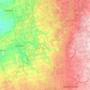
Name: West Grey topographic map, elevation, terrain.
Location: West Grey, Grey County, Ontario, Canada (43.96786 -81.06941 44.34240 -80.62370)
Average elevation: 1,171 ft
Minimum elevation: 774 ft
Maximum elevation: 1,631 ft
Other topographic maps
Click on a map to view its topography, its elevation and its terrain.