Koga topographic map
Click on the map to display elevation.
Koga
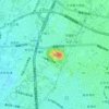
Koga is located in the extreme southwestern corner of Ibaraki Prefecture. Located almost in the center of the Kanto Plain, the city is very flat. The Tone River flows eastward in the southern part of the city and the Watarase River flows through the west and joins the Tone River north of the Tonegawa Bridge.The altitude of the northern part is slightly higher than that of the southern part, and the rivers that flow through the city flow from north to south except for the Tone River.
About this map

Name: Koga topographic map, elevation, terrain.
Location: Koga, Ibaraki Prefecture, Japan (36.12610 139.68769 36.23970 139.86596)
Average elevation: 62 ft
Minimum elevation: 13 ft
Maximum elevation: 121 ft
Other topographic maps
Click on a map to view its topography, its elevation and its terrain.
Mount Fuji
Japan > Sunto County > Oyama
Mount Fuji (富士山, Fujisan, Japanese: [ɸɯꜜ(d)ʑisaɴ] (listen)), or Fugaku, located on the island of Honshū, is the highest mountain in Japan, with a summit elevation of 3,776.24 m (12,389 ft 3 in). It is the second-highest volcano located on an island in Asia (after Mount Kerinci on the island of…
Average elevation: 10,709 ft
Mount Fuji
Japan > Sunto County > Oyama
Mount Fuji (富士山, Fujisan, Japanese: [ɸɯꜜ(d)ʑisaɴ] (listen)), or Fugaku, located on the island of Honshū, is the highest mountain in Japan, with a summit elevation of 3,776.24 m (12,389 ft 3 in). It is the second-highest volcano located on an island in Asia (after Mount Kerinci on the island of…
Average elevation: 10,709 ft



Mount Miyanoura
Japan > Kumage County > Yakushima
Mount Miyanoura (宮之浦岳, Miyanoura-dake) is a mountain in central Yakushima in Kagoshima Prefecture. At an altitude of 1,936 m (6,352 ft), it is the highest peak of Yakushima and also the highest peak of the Kyushu region. It is one of the 100 Famous Japanese Mountains.
Average elevation: 5,341 ft


Mount Fuji
Japan > Sunto County > Oyama
Mount Fuji (富士山, Fujisan, Japanese: [ɸɯꜜ(d)ʑisaɴ] (listen)), located on the island of Honshū, is an active stratovolcano in Japan, with a summit elevation of 3,776.24 m (12,389 ft 3 in). It is the tallest mountain in Japan, the second-highest volcano located on an island in Asia (after Mount…
Average elevation: 10,699 ft

Mount Yari
Two triangulation points were established at the summit. A milepost stone is fixed to the ground. As a reference point for the Geographical Survey Institute of Japan, it is of little importance and even on topographic maps, the summit of Yari-ga-take appears merely as an elevation point.
Average elevation: 8,550 ft



Mount Fuji
Japan > Sunto County > Oyama
Mount Fuji (富士山, Fujisan, Japanese: [ɸɯꜜ(d)ʑisaɴ] (listen)), located on the island of Honshū, is the highest mountain in Japan, with a summit elevation of 3,776.24 m (12,389 ft 3 in). It is the second-highest volcano located on an island in Asia (after Mount Kerinci on the island of Sumatra), and…
Average elevation: 10,709 ft


Mount Fuji
Japan > Sunto County > Oyama
Mount Fuji (富士山, Fujisan, Japanese: [ɸɯꜜ(d)ʑisaɴ] ) is an active stratovolcano located on the Japanese island of Honshu, with a summit elevation of 3,776.24 m (12,389 ft 3 in). It is the highest mountain in Japan, the second-highest volcano located on an island in Asia (after Mount Kerinci on the…
Average elevation: 10,709 ft


Mount Aso
Japan > Aso County > Minamiaso
With an elevation of 1,143 metres (3,750 ft)., Mount Aso has a climate that falls as humid continental (Köppen climate classification "Dfb"), with warm summers and cold winters. Precipitation is high throughout the year, which brings the area to have borderline subtropical characteristics as well. It is…
Average elevation: 4,114 ft


Mount Naka
Mount Naka (中岳, Naka-dake) is a mountain with an altitude of 3,084m located in the southern part of the Hida Mountains, which straddles Matsumoto in Nagano Prefecture and Takayama in Gifu Prefecture. This mountain is located in Chūbu-Sangaku National Park.
Average elevation: 8,619 ft


Mount Fuji
Japan > Sunto County > Oyama
Mount Fuji (富士山・富士の山, Fujisan, Fuji no Yama) is an active stratovolcano located on the Japanese island of Honshu, with a summit elevation of 3,776.24 m (12,389 ft 3 in). It is the highest mountain in Japan, the second-highest volcano on any Asian island (after Mount Kerinci on the Indonesian…
Average elevation: 10,709 ft
Mount Fuji
Japan > Sunto County > Oyama
Mount Fuji (富士山・富士の山, Fujisan, Fuji no Yama) is an active stratovolcano located on the Japanese island of Honshu, with a summit elevation of 3,776.24 m (12,389 ft 3 in). It is the highest mountain in Japan, the second-highest volcano on any Asian island (after Mount Kerinci on the Indonesian…
Average elevation: 10,709 ft




Mount Fuji
Japan > Sunto County > Oyama
Mount Fuji (富士山・富士の山, Fujisan, Fuji no Yama) is an active stratovolcano located on the Japanese island of Honshu, with a summit elevation of 3,776.24 m (12,389 ft 3 in). It is the highest mountain in Japan, the second-highest volcano on any Asian island (after Mount Kerinci on the Indonesian…
Average elevation: 10,709 ft
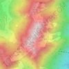
Mt. Tate
Japan > Nakaniikawa County > Tateyama
The mountain is primarily composed of granite and gneiss. However, located along the ridge and plateau, about 2 km (1.2 mi) west of the summit, there is a small andesite-dacite stratovolcano. This volcano has an elevation of 2,621 m (8,599 ft) and has minor eruptions, the latest occurring in 1961.
Average elevation: 8,386 ft
Mount Fuji
Japan > Sunto County > Oyama
Mount Fuji (富士山, Fujisan, Japanese: [ɸɯꜜ(d)ʑisaɴ] ) is an active stratovolcano located on the Japanese island of Honshu, with a summit elevation of 3,776.24 m (12,389 ft 3 in). It is the tallest mountain in Japan, the second-highest volcano located on an island in Asia (after Mount Kerinci on the…
Average elevation: 10,699 ft
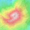
Mount Chōkai
Japan > Akumi County > Yuza
Mount Chōkai is shared by two municipalities in Akita Prefecture and four municipalities Yamagata Prefecture; however, its peak is located in Yuza, on the Yamagata side of the border. It is therefore the highest peak in Yamagata, and the second highest in the Tōhoku region after Mt. Hiuchigatake (altitude…
Average elevation: 5,932 ft
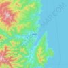
Mount Aso
Japan > Aso County > Minamiaso
With an elevation of 1,143 metres (3,750 ft)., Mount Aso has a climate that falls as humid continental (Köppen climate classification "Dfb"), with warm summers and cold winters. Precipitation is high throughout the year, which brings the area to have borderline subtropical characteristics as well. It is…
Average elevation: 4,114 ft

Mount Tateshina
It has an elevation of 2,530 m (8,301 ft). This mountain is one of the 100 Famous Japanese Mountains.
Average elevation: 6,831 ft




Mount Fuji
Japan > Sunto County > Oyama
Mount Fuji (富士山, Fujisan, Japanese: [ɸɯꜜ(d)ʑisaɴ] (listen)), located on the island of Honshū, is the highest mountain in Japan, with a summit elevation of 3,776.24 m (12,389 ft 3 in). It is the second-highest volcano located on an island in Asia (after Mount Kerinci on the island of Sumatra), and…
Average elevation: 10,709 ft
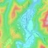
Shirakawa
Shirakawa is a mountain village located in far northern Gifu Prefecture, bordering Ishikawa Prefecture and Toyama Prefecture on the Ryōhaku Mountains. Mount Hakusan is the highest elevation at 2,172 metres (7,126 ft). The village's area is 95.7% mountainous forests, and its steep places are characteristic. In…
Average elevation: 2,188 ft