Geolocate

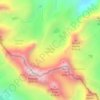
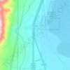
Wildrose Peak topographic map

Click on the map to display elevation.

About this map

Name: Wildrose Peak topographic map, elevation, terrain.

Location: Wildrose Peak, Inyo County, California, United States (36.27573 -117.07900 36.27583 -117.07890)

Average elevation: 7,881 ft

Minimum elevation: 5,600 ft

Maximum elevation: 9,062 ft

Inyo County trails, hiking, mountain biking, running and outdoor activities

Other topographic maps

Click on a map to view its topography, its elevation and its terrain.
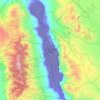
Owens Valley

United States > California > Inyo County

Average elevation: 6,857 ft

Death Valley Playa

United States > California > Inyo County

Average elevation: 2,881 ft

Racetrack Playa

United States > California > Inyo County

Average elevation: 3,999 ft

Big Pine Creek

United States > California > Inyo County > Big Pine

Average elevation: 3,970 ft

Palisade Glacier

United States > California > Inyo County

Average elevation: 12,595 ft

West Bishop

United States > California > Inyo County

Average elevation: 4,859 ft

Upper Lamarck Lake

United States > California > Inyo County

Average elevation: 11,342 ft

Gem Lakes

United States > California > Inyo County

Average elevation: 11,421 ft

Cartago

United States > California > Inyo County

Cartago (Spanish for "Carthage") is a census-designated place in Inyo County, California, United States. Cartago is located on the west side of Owens Lake 3 miles (4.8 km) north-northwest of Olancha, at an elevation of 3629 feet (1106 m). The population was 92 at the 2010 census, down from 109 at the 2000…

Average elevation: 3,780 ft
Darwin

United States > California > Inyo County

Darwin is an unincorporated mining community in Inyo County, California, United States. It is located 22 miles (35 km) southeast of Keeler, at an elevation of 4,790 ft (1,460 m). The population was 43 at the 2010 census, down from 54 at the 2000 census.

Average elevation: 4,869 ft
Pearsonville

United States > California > Inyo County

Average elevation: 2,612 ft

Trona

United States > California > Inyo County

Average elevation: 1,867 ft

Gear up for your next adventure:

🎒Waterproof Dry Bags - Keep your electronics and maps dry inside your pack
🥾Hiking Shoes - Durable and comfortable shoes for trail hiking
🎁Geography Themed Gifts - Unique gift ideas for map lovers and geography enthusiasts
🔌USB Car Charger - Car charger for on‑the‑go power needs
🎒Trail Energy Bars - High‑calorie bars for hiking energy

As an Amazon Associate, this site earns from qualifying purchases at no extra cost to you.