
仙游县 topographic map
Interactive map
Click on the map to display elevation.
About this map
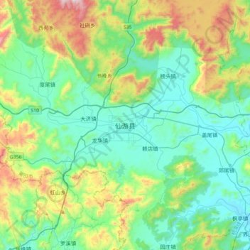
Name: 仙游县 topographic map, elevation, terrain.
Location: 仙游县, 莆田市, 福建省, 中国 (25.20349 118.52684 25.52349 118.84684)
Average elevation: 978 ft
Minimum elevation: 13 ft
Maximum elevation: 3,888 ft
地形西北高、东南低,最高点西苑凤山石谷解海拔1803.3米,最低处枫亭海滨村海拔仅5米。主要有木兰溪、延寿溪、枫慈溪、粗溪和九溪5条溪流,流域面积1805平方公里;木兰溪为境内第一大河流,流经县境东南部,从莆田三江口注入兴化湾,为潮汐所吞纳。
Other topographic maps
Click on a map to view its topography, its elevation and its terrain.