
达巴乡 topographic map
Interactive map
Click on the map to display elevation.
About this map
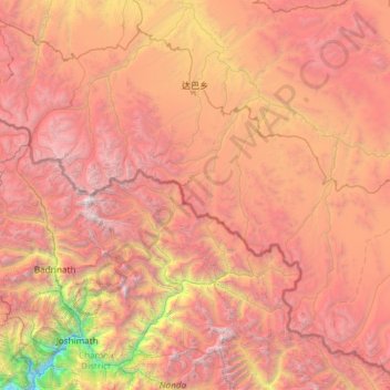
Name: 达巴乡 topographic map, elevation, terrain.
Location: 达巴乡, 札达县, 阿里地区, 西藏自治区, 中国 (30.44830 79.74272 31.42617 80.94048)
Average elevation: 15,525 ft
Minimum elevation: 5,062 ft
Maximum elevation: 25,069 ft
Other topographic maps
Click on a map to view its topography, its elevation and its terrain.