
托林镇 topographic map
Interactive map
Click on the map to display elevation.
About this map
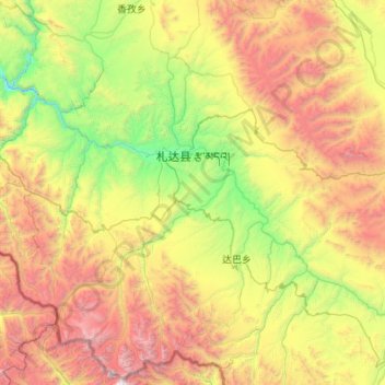
Name: 托林镇 topographic map, elevation, terrain.
Location: 托林镇, 札达县, 阿里地区, 西藏自治区, 中国 (30.93881 79.22052 31.83600 80.30665)
Average elevation: 15,541 ft
Minimum elevation: 11,165 ft
Maximum elevation: 23,862 ft
Other topographic maps
Click on a map to view its topography, its elevation and its terrain.