
Conway topographic map
Interactive map
Click on the map to display elevation.
About this map
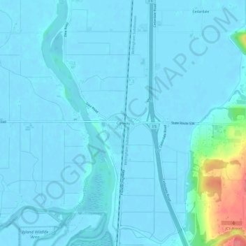
Name: Conway topographic map, elevation, terrain.
Location: Conway, Skagit County, Washington, 98238, United States (48.32108 -122.36276 48.36108 -122.32276)
Average elevation: 23 ft
Minimum elevation: -7 ft
Maximum elevation: 269 ft
Skagit County trails, hiking, mountain biking, running and outdoor activities
Other topographic maps
Click on a map to view its topography, its elevation and its terrain.
Saddlebag Island Marine State Park
United States > Washington > Skagit County
Average elevation: 10 ft
Concrete
United States > Washington > Skagit County
Mears Field (3W5), formerly known as Concrete Municipal Airport, is located one mile south of Concrete at an elevation of 267 ft MSL.
Average elevation: 410 ft