
Fairfield topographic map
Click on the map to display elevation.
About this map
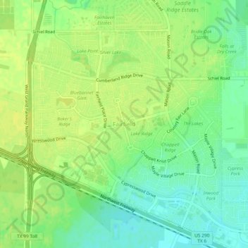
Name: Fairfield topographic map, elevation, terrain.
Location: Fairfield, Harris County, Texas, United States (29.98539 -95.77149 30.02539 -95.73149)
Average elevation: 184 ft
Minimum elevation: 148 ft
Maximum elevation: 203 ft
Harris County trails, hiking, mountain biking, running and outdoor activities
Other topographic maps
Click on a map to view its topography, its elevation and its terrain.
Spring Valley
United States > Texas > Harris County
In 1936 state highway maps indicated a cemetery and a church. Initially the settlement consisted of one and one-half square miles.Spring Valley, once known as Lusk, is at the intersection of Farm roads 2416 and 2113, fourteen miles southwest of Waco in southwestern McLennan County. A post office, called Lusk…
Average elevation: 82 ft
original boundary of City of Houston
United States > Texas > Harris County > Houston
Average elevation: 52 ft
Addicks Reservoir
United States > Texas > Harris County > Houston
Addicks Reservoir is formed by a rolled earthen dam 61,666 feet (18,796 m) long and above the streambed. A 12-foot-wide (3.7 m) gravel road extends along the top of the dam. The top of the dam has a maximum elevation of 121 feet (37 m) above the NAVD 1988 and is almost 50 feet high in points. The maximum…
Average elevation: 102 ft