
Bellaire topographic map
Click on the map to display elevation.
About this map
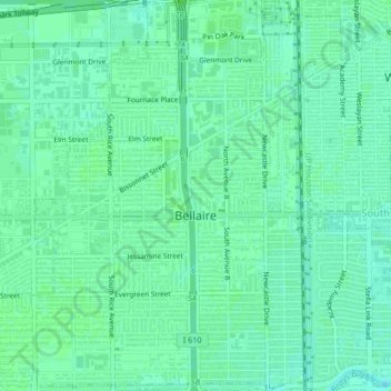
Name: Bellaire topographic map, elevation, terrain.
Location: Bellaire, Harris County, Texas, United States (29.68940 -95.48445 29.72589 -95.44722)
Average elevation: 66 ft
Minimum elevation: 49 ft
Maximum elevation: 72 ft
Harris County trails, hiking, mountain biking, running and outdoor activities
Other topographic maps
Click on a map to view its topography, its elevation and its terrain.
Highlands
United States > Texas > Harris County
The community was named Highlands because the east bank of the San Jacinto River, where Highlands is located, has a higher elevation than the west bank of the river. By 1908, Highlands became a station on the Beaumont, Sour Lake and Western Railway. A post office opened in 1929. Highlands incorporated in 1930,…
Average elevation: 26 ft
Challenger 7 Memorial Park
United States > Texas > Harris County > League City
Average elevation: 20 ft