
Lake Murray topographic map
Click on the map to display elevation.
About this map
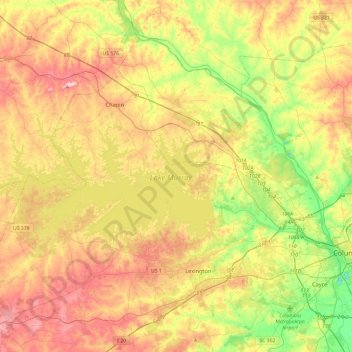
Name: Lake Murray topographic map, elevation, terrain.
Location: Lake Murray, Lexington County, South Carolina, United States (33.99849 -81.69007 34.17160 -81.21652)
Average elevation: 371 ft
Minimum elevation: 108 ft
Maximum elevation: 787 ft
Lexington County trails, hiking, mountain biking, running and outdoor activities
Other topographic maps
Click on a map to view its topography, its elevation and its terrain.
Peachtree Rock Heritage Preserve
United States > South Carolina > Lexington County
Average elevation: 486 ft
Edenwood
United States > South Carolina > Lexington County > Cayce > Edenwood
Average elevation: 167 ft