
Norman Creek topographic map
Interactive map
Click on the map to display elevation.
About this map
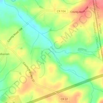
Name: Norman Creek topographic map, elevation, terrain.
Location: Norman Creek, Cleburne County, Alabama, 36269, USA (33.68117 -85.36044 33.68244 -85.35878)
Average elevation: 1,001 ft
Minimum elevation: 889 ft
Maximum elevation: 1,112 ft
Other topographic maps
Click on a map to view its topography, its elevation and its terrain.
Cheaha Mountain
Cheaha Mountain, Cleburne County, Alabama, USA
Average elevation: 1,781 ft
East Chapman
USA > Alabama > East Chapman
East Chapman, Butler County, Alabama, 36033, USA
Average elevation: 305 ft
Clear Creek Campground
USA > Alabama > Falls City
Clear Creek Campground, County Road 8, Falls City, Winston County, Alabama, USA
Average elevation: 591 ft
Tennessee River
Tennessee River, Madison County, Alabama, 35754:35803, USA
Average elevation: 801 ft