
Ford topographic map
Click on the map to display elevation.
About this map
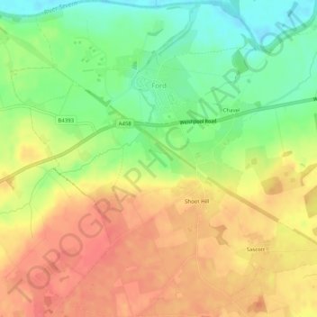
Name: Ford topographic map, elevation, terrain.
Location: Ford, Shropshire, England, United Kingdom (52.69462 -2.89157 52.72513 -2.84255)
Average elevation: 285 ft
Minimum elevation: 177 ft
Maximum elevation: 374 ft
Other topographic maps
Click on a map to view its topography, its elevation and its terrain.
Minton
United Kingdom > England > Shropshire > Church Stretton > Little Stretton
Average elevation: 892 ft
Cothercott Hill
United Kingdom > England > Shropshire > Church Pulverbatch
Average elevation: 1,122 ft