Geolocate

Mahan topographic map

Click on the map to display elevation.

About this map

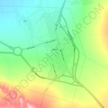
Name: Mahan topographic map, elevation, terrain.

Location: Mahan, بخش ماهان, Kerman County, Kerman Province, Iran (30.01456 57.22344 30.08542 57.31482)

Average elevation: 6,378 ft

Minimum elevation: 6,027 ft

Maximum elevation: 7,037 ft

Other topographic maps

Click on a map to view its topography, its elevation and its terrain.

Shahdad

Iran > Kerman Province > Kerman County > Shahdad

Average elevation: 1,483 ft

Langar

Iran > Kerman Province > Kerman County > Mahan

Average elevation: 6,112 ft

حوض نخعی

Iran > Kerman Province > Kerman County > Kerman

Average elevation: 5,768 ft

Qanateghestan

Iran > Kerman Province > Kerman County

Average elevation: 6,093 ft

Langar

Iran > Kerman Province > Kerman County > Mahan

Average elevation: 6,112 ft

Gear up for your next adventure:

🔭Telescopic Hiking Pole - Adjustable pole for hiking stability
🥤Water Filter Bottle - All‑in‑one filter bottle for safe hydration
🎁Geography Themed Gifts - Unique gift ideas for map lovers and geography enthusiasts
🖼️Topo Map Wall Art - Decorative topographic prints of famous peaks and regions
🧭Orienteering Set - Complete compass and map reading kit

As an Amazon Associate, this site earns from qualifying purchases at no extra cost to you.