Geolocate

Panorama Ridge topographic map

Click on the map to display elevation.

About this map

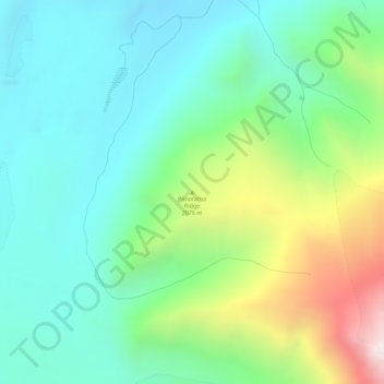
Name: Panorama Ridge topographic map, elevation, terrain.

Location: Panorama Ridge, Yukon, Canada (61.24213 -140.14553 61.24223 -140.14543)

Average elevation: 6,283 ft

Minimum elevation: 5,440 ft

Maximum elevation: 8,442 ft

Other topographic maps

Click on a map to view its topography, its elevation and its terrain.

Porter Creek

Canada > Yukon > Whitehorse

Average elevation: 2,329 ft

Haines Junction

Canada > Yukon

Average elevation: 2,060 ft

Carmacks

Canada > Yukon

Average elevation: 2,034 ft

Teslin Post 13

Canada > Yukon

Average elevation: 2,280 ft

Bear Creek

Canada > Yukon

Average elevation: 2,116 ft

Burwash Landing

Canada > Yukon > Burwash Landing

Average elevation: 2,717 ft

Destruction Bay

Canada > Yukon > Destruction Bay

Average elevation: 2,930 ft

Bear Creek

Canada > Yukon > Bear Creek

Average elevation: 2,119 ft

Victoria Lake

Canada > Yukon

Average elevation: 3,192 ft

Teslin

Canada > Yukon > Teslin

Average elevation: 2,300 ft

Beaver Creek

Canada > Yukon > Beaver Creek

Average elevation: 2,195 ft

Sambo Creek

Canada > Yukon

Average elevation: 2,218 ft

Gear up for your next adventure:

🥄Camping Utensil Set - Lightweight utensils for outdoor meals
🪶Paracord Bracelet - Survival bracelet with built‑in tools
🔭Stargazing Telescopes - Perfect for camping in low-light pollution areas shown on maps
🔦Compact Flashlight - Reliable flashlight for emergencies
🪵Folding Camp Saw - Compact saw for wood and campsite work

As an Amazon Associate, this site earns from qualifying purchases at no extra cost to you.