
Sophia topographic map
Click on the map to display elevation.
About this map
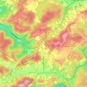
Name: Sophia topographic map, elevation, terrain.
Location: Sophia, Raleigh County, West Virginia, United States (37.70115 -81.26739 37.74063 -81.23061)
Average elevation: 2,434 ft
Minimum elevation: 2,054 ft
Maximum elevation: 2,694 ft
Raleigh County trails, hiking, mountain biking, running and outdoor activities
Other topographic maps
Click on a map to view its topography, its elevation and its terrain.
Old Mill Village
United States > West Virginia > Raleigh County > Mabscott
Average elevation: 2,421 ft
Johnstown
United States > West Virginia > Raleigh County > Beckley > Sprague
Average elevation: 2,326 ft