Geolocate

Silver Lake topographic map

Click on the map to display elevation.

About this map

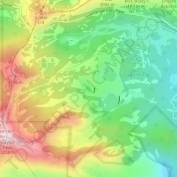
Name: Silver Lake topographic map, elevation, terrain.

Location: Silver Lake, Wasatch County, Utah, United States (40.59757 -111.54420 40.59857 -111.54317)

Average elevation: 9,491 ft

Minimum elevation: 8,645 ft

Maximum elevation: 10,676 ft

Wasatch County trails, hiking, mountain biking, running and outdoor activities

Other topographic maps

Click on a map to view its topography, its elevation and its terrain.

Heber City

United States > Utah > Wasatch County > Heber > Heber City

Average elevation: 5,771 ft

Timber Lakes

United States > Utah > Wasatch County

Average elevation: 8,179 ft

Soapstone Mountain

United States > Utah > Wasatch County

Average elevation: 8,924 ft

Charleston

United States > Utah > Wasatch County

Average elevation: 5,528 ft

Daniel

United States > Utah > Wasatch County

Average elevation: 6,129 ft

Phosphate Hill

United States > Utah > Wasatch County

Average elevation: 6,309 ft

Jordanelle

United States > Utah > Wasatch County

Average elevation: 6,447 ft

Gear up for your next adventure:

📖Nature Tracking Books - Learn to track wildlife and terrain
🥤Water Filter Bottle - All‑in‑one filter bottle for safe hydration
🎒Gear Packing Cubes - Organize your backpack efficiently
📦Gear Storage Bags - Organize and protect outdoor equipment
🦶Hiking Gaiters - Keep debris and water out of your boots

As an Amazon Associate, this site earns from qualifying purchases at no extra cost to you.