
Make a donation
Gear up for your next adventure:
As an Amazon Associate, this site earns from qualifying purchases at no extra cost to you.
Faisalabad City Tehsil topographic map
Click on the map to display elevation.
Make a donation
Gear up for your next adventure:
As an Amazon Associate, this site earns from qualifying purchases at no extra cost to you.
Faisalabad City Tehsil
The soil consists of young stratified silt loam or very fine sand loam which makes the subsoil weak in structure with common kankers at only five feet. The course of the rivers within Faisalabad is winding and often subject to frequent alternations. In the rainy season, the currents are very strong. This leads to high floods in certain areas which do last for a number of days. The Rakh and Gogera canals have encouraged the water levels in the district however the belt on the Ravi River has remained narrow. The river bed does include the river channels which have shifted the sand bars and low sandy levees leading to river erosion. Faisalabad is situated at the centre of the lower Rechna Doab, the area is located between the Chenab and Ravi rivers. There is a mild slope from the northeast to the southwest with an average fall of 0.2–0.3 metres per kilometre (1.1–1.6 feet per mile). The city is situated at an elevation of about 183 metres (600 ft). The topography is marked by valleys, local depression and high ground.
Make a donation
Gear up for your next adventure:
As an Amazon Associate, this site earns from qualifying purchases at no extra cost to you.
About this map
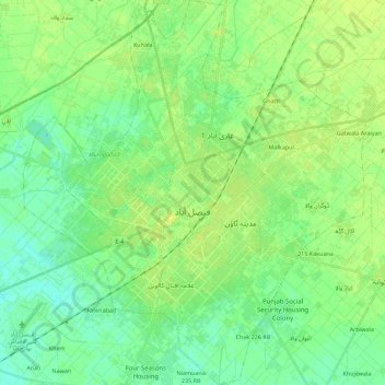
Name: Faisalabad City Tehsil topographic map, elevation, terrain.
Average elevation: 607 ft
Minimum elevation: 584 ft
Maximum elevation: 627 ft
Make a donation
Gear up for your next adventure:
As an Amazon Associate, this site earns from qualifying purchases at no extra cost to you.
Other topographic maps
Click on a map to view its topography, its elevation and its terrain.
Make a donation
Gear up for your next adventure:
As an Amazon Associate, this site earns from qualifying purchases at no extra cost to you.
Make a donation
Gear up for your next adventure:
As an Amazon Associate, this site earns from qualifying purchases at no extra cost to you.
Murree
Pakistan > Punjab > Murree District
Murree (Punjabi, Urdu: مری) is a mountain resort city, located in the Galyat region of the Pir Panjal Range, within the Muree District of Punjab, Pakistan. It forms the outskirts of the Islamabad-Rawalpindi metropolitan area, and is about 30 km (19 mi) northeast of Islamabad. It has average altitude of…
Average elevation: 5,636 ft
Make a donation
Gear up for your next adventure:
As an Amazon Associate, this site earns from qualifying purchases at no extra cost to you.
Make a donation
Gear up for your next adventure:
As an Amazon Associate, this site earns from qualifying purchases at no extra cost to you.
Make a donation
Gear up for your next adventure:
As an Amazon Associate, this site earns from qualifying purchases at no extra cost to you.
Make a donation
Gear up for your next adventure:
As an Amazon Associate, this site earns from qualifying purchases at no extra cost to you.
Make a donation
Gear up for your next adventure:
As an Amazon Associate, this site earns from qualifying purchases at no extra cost to you.
Make a donation
Gear up for your next adventure:
As an Amazon Associate, this site earns from qualifying purchases at no extra cost to you.
Make a donation
Gear up for your next adventure:
As an Amazon Associate, this site earns from qualifying purchases at no extra cost to you.
Make a donation
Gear up for your next adventure:
As an Amazon Associate, this site earns from qualifying purchases at no extra cost to you.
Make a donation
Gear up for your next adventure:
As an Amazon Associate, this site earns from qualifying purchases at no extra cost to you.
Make a donation
Gear up for your next adventure:
As an Amazon Associate, this site earns from qualifying purchases at no extra cost to you.
Make a donation
Gear up for your next adventure:
As an Amazon Associate, this site earns from qualifying purchases at no extra cost to you.
Murree
Pakistan > Punjab > Murree District
Murree is a mountain resort city in the northernmost region of the Punjab province of Pakistan. Lying in the Galyat region of the Pir Panjal Range under the western Himalayas, it is located in the northeast of the capital city of Islamabad. The town was built in the mid-19th century and served as the summer…
Average elevation: 5,636 ft
Make a donation
Gear up for your next adventure:
As an Amazon Associate, this site earns from qualifying purchases at no extra cost to you.
Make a donation
Gear up for your next adventure:
As an Amazon Associate, this site earns from qualifying purchases at no extra cost to you.
Murree
Pakistan > Punjab > Murree District
Murree is a mountain resort city in the northernmost region of the Punjab province of Pakistan. Lying in the Galyat region of the Pir Panjal Range under the western Himalayas, it is located in the northeast of the capital city of Islamabad. The town was built in the mid-19th century and served as the summer…
Average elevation: 5,636 ft
Make a donation
Gear up for your next adventure:
As an Amazon Associate, this site earns from qualifying purchases at no extra cost to you.
Panjpeer Rocks
Pakistan > Punjab > Rawalpindi District > Kotli Sattian Tehsil
Average elevation: 4,810 ft
Make a donation
Gear up for your next adventure:
As an Amazon Associate, this site earns from qualifying purchases at no extra cost to you.
Make a donation
Gear up for your next adventure:
As an Amazon Associate, this site earns from qualifying purchases at no extra cost to you.
Make a donation
Gear up for your next adventure:
As an Amazon Associate, this site earns from qualifying purchases at no extra cost to you.
Kartarpur
Pakistan > Punjab > Kohta Kalan
Kartarpur is located at 32°5′13″N 75°1′0″E / 32.08694°N 75.01667°E / 32.08694; 75.01667, at an average elevation of 155 metres (511 feet). It lies upon the western banks of the Ravi River, opposite the town of Dera Baba Nanak, a sacred town in Sikhism.
Average elevation: 791 ft
Make a donation
Gear up for your next adventure:
As an Amazon Associate, this site earns from qualifying purchases at no extra cost to you.
Make a donation
Gear up for your next adventure:
As an Amazon Associate, this site earns from qualifying purchases at no extra cost to you.
Make a donation
Gear up for your next adventure:
As an Amazon Associate, this site earns from qualifying purchases at no extra cost to you.
Make a donation
Gear up for your next adventure:
As an Amazon Associate, this site earns from qualifying purchases at no extra cost to you.
Make a donation
Gear up for your next adventure:
As an Amazon Associate, this site earns from qualifying purchases at no extra cost to you.
Make a donation
Gear up for your next adventure:
As an Amazon Associate, this site earns from qualifying purchases at no extra cost to you.