Geolocate

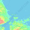
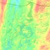
Labrador topographic map

Click on the map to display elevation.

About this map
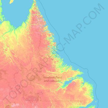
Name: Labrador topographic map, elevation, terrain.

Location: Labrador, Newfoundland and Labrador, Canada (51.34592 -67.82169 60.47703 -55.20510)

Average elevation: 728 ft

Minimum elevation: -3 ft

Maximum elevation: 4,780 ft

Other topographic maps

Click on a map to view its topography, its elevation and its terrain.
Bell Island

Canada > Newfoundland and Labrador

Average elevation: 30 ft

Labrador

Canada > Newfoundland and Labrador

Average elevation: 2,211 ft

Englee

Canada > Newfoundland and Labrador > Englee

Average elevation: 112 ft

Mount Caubvick

Canada > Newfoundland and Labrador

Average elevation: 4,173 ft

Highway 220

Canada > Newfoundland and Labrador

Average elevation: 26 ft

Whitbourne

Canada > Newfoundland and Labrador > Whitbourne

Average elevation: 230 ft

Grosse Point

Canada > Newfoundland and Labrador

Average elevation: 82 ft
Ragged Point

Canada > Newfoundland and Labrador

Average elevation: 20 ft

Bridgeport

Canada > Newfoundland and Labrador

Average elevation: 72 ft

Monroe

Canada > Newfoundland and Labrador

Average elevation: 135 ft

Smokey

Canada > Newfoundland and Labrador > Smokey

Average elevation: 46 ft

Tims Hill

Canada > Newfoundland and Labrador

Average elevation: 413 ft

Gear up for your next adventure:

🧭GPS Watch Accessories - Bands and chargers for GPS watches
🪶Wildlife Field Guides - Learn animal tracking and species ID
🎒Trail Energy Bars - High‑calorie bars for hiking energy
🛡️Insect Repellent - Protection against bugs during outdoor activities
🧤Tactile Hiking Gloves - Keep hands warm while operating GPS and smartphone screens

As an Amazon Associate, this site earns from qualifying purchases at no extra cost to you.