
中连川乡 topographic map
Interactive map
Click on the map to display elevation.
About this map
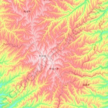
Name: 中连川乡 topographic map, elevation, terrain.
Location: 中连川乡, 榆中县, 兰州市, 甘肃省, 中国 (35.92318 104.32336 36.19757 104.57455)
Average elevation: 7,231 ft
Minimum elevation: 6,007 ft
Maximum elevation: 8,173 ft
Other topographic maps
Click on a map to view its topography, its elevation and its terrain.