
Romsley topographic map
Click on the map to display elevation.
About this map
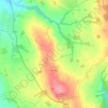
Name: Romsley topographic map, elevation, terrain.
Location: Romsley, Shropshire, England, United Kingdom (52.43621 -2.34231 52.46584 -2.28739)
Average elevation: 440 ft
Minimum elevation: 259 ft
Maximum elevation: 627 ft
Other topographic maps
Click on a map to view its topography, its elevation and its terrain.