
Battlefield topographic map
Click on the map to display elevation.
About this map
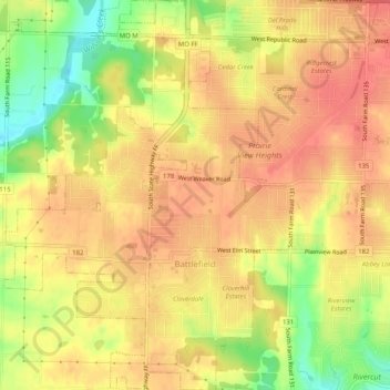
Name: Battlefield topographic map, elevation, terrain.
Location: Battlefield, Greene County, Missouri, 65619, United States (37.10236 -93.38907 37.14263 -93.35182)
Average elevation: 1,243 ft
Minimum elevation: 1,115 ft
Maximum elevation: 1,306 ft
Greene County trails, hiking, mountain biking, running and outdoor activities
Other topographic maps
Click on a map to view its topography, its elevation and its terrain.