Geolocate

Tarrytown Neighborhood Park topographic map

Click on the map to display elevation.

About this map

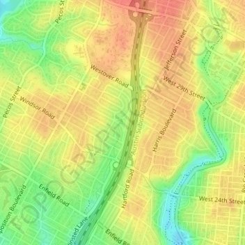
Name: Tarrytown Neighborhood Park topographic map, elevation, terrain.

Location: Tarrytown Neighborhood Park, Old West Austin, Austin, Travis County, Texas, United States (30.29587 -97.76101 30.29751 -97.75940)

Average elevation: 587 ft

Minimum elevation: 489 ft

Maximum elevation: 650 ft

Travis County trails, hiking, mountain biking, running and outdoor activities

Other topographic maps

Click on a map to view its topography, its elevation and its terrain.

Lady Bird Lake

United States > Texas > Travis County > Austin

Average elevation: 561 ft

Hill of Life Falls

United States > Texas > Travis County > Austin

Average elevation: 764 ft

Mount Bonnell

United States > Texas > Travis County > Austin

Average elevation: 620 ft

Lake Austin

United States > Texas > Travis County > Austin

Average elevation: 794 ft

Cat Mountain

United States > Texas > Travis County > Austin

Average elevation: 679 ft

Mount Barker

United States > Texas > Travis County > Austin

Average elevation: 633 ft

Gear up for your next adventure:

🪶Survival Guide Book - Expert advice for emergency preparedness
🎒Trekking Poles - Sturdy poles for balance and stability on rough terrain
🛠️Backpacking Tool Kit - Essential toolkit for outdoor repairs
🪶LED Camping Lantern - Bright lantern for camp lighting
📦Dry Bags Set - Waterproof storage for electronics and clothes

As an Amazon Associate, this site earns from qualifying purchases at no extra cost to you.