Geolocate

Pontassieve topographic map

Click on the map to display elevation.

About this map

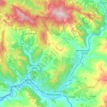
Name: Pontassieve topographic map, elevation, terrain.

Location: Pontassieve, Unione di Comuni Valdarno e Valdisieve, Florence, Tuscany, 50065, Italy (43.76843 11.33973 43.88466 11.53105)

Average elevation: 1,194 ft

Minimum elevation: 187 ft

Maximum elevation: 3,202 ft

Other topographic maps

Click on a map to view its topography, its elevation and its terrain.

Budello di Monte Morello

Italy > Tuscany > Florence > Sesto Fiorentino

Average elevation: 1,142 ft

Poggiolo-Salaiole

Italy > Tuscany > Florence > Borgo San Lorenzo

Average elevation: 1,263 ft

Sommaia

Italy > Tuscany > Florence > Calenzano

Average elevation: 669 ft

Grassina

Italy > Tuscany > Florence > Bagno a Ripoli

Average elevation: 469 ft

Montisoni

Italy > Tuscany > Florence > Bagno a Ripoli

Average elevation: 1,017 ft

San Donato in Collina

Italy > Tuscany > Florence > Bagno a Ripoli

Average elevation: 1,250 ft

Le Bagnese

Italy > Tuscany > Florence > Scandicci

Average elevation: 217 ft

Troghi

Italy > Tuscany > Florence > Rignano sull'Arno

Average elevation: 1,178 ft

Strada in Chianti

Italy > Tuscany > Florence > Greve in Chianti

Average elevation: 692 ft

Castello di Mugnana

Italy > Tuscany > Florence > Greve in Chianti > Chiocchio > Mugnana

Average elevation: 1,063 ft

Strada in Chianti

Italy > Tuscany > Florence > Greve in Chianti

Average elevation: 692 ft

Settignano

Italy > Tuscany > Florence > Florence

Average elevation: 518 ft

Vallina

Italy > Tuscany > Florence > Bagno a Ripoli

Average elevation: 676 ft

Serpiolle

Italy > Tuscany > Florence > Florence

Average elevation: 614 ft

Vitiana

Italy > Tuscany > Florence > Empoli

Average elevation: 128 ft

Leccio

Italy > Tuscany > Florence > Reggello

Average elevation: 545 ft

Panzano in Chianti

Italy > Tuscany > Florence > Greve in Chianti

Average elevation: 1,302 ft

San Donato

Italy > Tuscany > Florence > Castelfiorentino

Average elevation: 240 ft

Galleno

Italy > Tuscany > Florence > Fucecchio

Average elevation: 118 ft

Bassa

Italy > Tuscany > Florence > Cerreto Guidi

Average elevation: 115 ft

Il Torrino

Italy > Tuscany > Florence > Fontebuona

Average elevation: 1,499 ft

Montefioralle

Italy > Tuscany > Florence > Greve in Chianti

Average elevation: 1,135 ft

Cavallina

Italy > Tuscany > Florence > Barberino di Mugello

Average elevation: 971 ft

Scarperia

Italy > Tuscany > Florence

Average elevation: 902 ft

Mezzomonte

Italy > Tuscany > Florence > Impruneta > Pozzolatico

Average elevation: 574 ft

Scarperia

Italy > Tuscany > Florence

Average elevation: 902 ft

Settignano

Italy > Tuscany > Florence > Florence

Average elevation: 518 ft

Cintoia

Italy > Tuscany > Florence > Florence > Mantignano

Average elevation: 135 ft

Botinaccio

Italy > Tuscany > Florence > Montespertoli

Average elevation: 512 ft

Sant'Agostino

Italy > Tuscany > Florence > Gambassi Terme

Average elevation: 807 ft

Morrocco

Italy > Tuscany > Florence > Sambuca

Average elevation: 945 ft

Due Strade

Italy > Tuscany > Florence > Florence

Average elevation: 305 ft

Morrocco

Italy > Tuscany > Florence > Sambuca

Average elevation: 945 ft

Gear up for your next adventure:

💧Water Purification System - Clean water on the trail with reliable purifiers
🪶Camp Gear Gift Set - Perfect gift bundle for outdoor fans
❄️Traction Cleats - Prevent slips on icy trails during winter hikes
🧭Orienteering Set - Complete compass and map reading kit
🗃️Trail First Aid Kit - Essential kit for outdoor injuries and emergencies

As an Amazon Associate, this site earns from qualifying purchases at no extra cost to you.