
Balanga topographic map
Click on the map to display elevation.
About this map
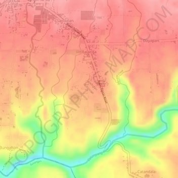
Name: Balanga topographic map, elevation, terrain.
Location: Balanga, Ibaan, Batangas, Calabarzon, 4230, Philippines (13.79038 121.13276 13.81411 121.14812)
Average elevation: 305 ft
Minimum elevation: 46 ft
Maximum elevation: 400 ft
Other topographic maps
Click on a map to view its topography, its elevation and its terrain.