Geolocate

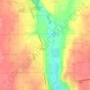
Woodbourne topographic map

Click on the map to display elevation.

About this map

Name: Woodbourne topographic map, elevation, terrain.

Location: Woodbourne, Washington Township, Montgomery County, Ohio, 45459, United States (39.63923 -84.17827 39.67923 -84.13827)

Average elevation: 955 ft

Minimum elevation: 817 ft

Maximum elevation: 1,093 ft

Montgomery County trails, hiking, mountain biking, running and outdoor activities

Other topographic maps

Click on a map to view its topography, its elevation and its terrain.

Dayton

United States > Ohio > Montgomery County

Dayton is situated on a low floodplain primarily shaped by the Great Miami River and its tributaries, including the Stillwater and Mad rivers. The city's terrain features a relatively flat landscape, with elevations averaging around 738 feet (225 meters) above sea level. This low-lying area is characterized by…

Average elevation: 886 ft

Germantown

United States > Ohio > Montgomery County

Average elevation: 781 ft

Vandalia

United States > Ohio > Montgomery County

Average elevation: 919 ft

Brookville

United States > Ohio > Montgomery County

Average elevation: 1,037 ft

Union

United States > Ohio > Montgomery County

Average elevation: 925 ft

Kettering

United States > Ohio > Montgomery County

Average elevation: 902 ft

Miamisburg

United States > Ohio > Montgomery County

Average elevation: 810 ft

Englewood

United States > Ohio > Montgomery County

Average elevation: 925 ft

Miami Township

United States > Ohio > Montgomery County

Average elevation: 892 ft

Riverside

United States > Ohio > Montgomery County

Average elevation: 840 ft

Trotwood

United States > Ohio > Montgomery County

Average elevation: 902 ft

Oakwood

United States > Ohio > Montgomery County

Average elevation: 922 ft

West Carrollton

United States > Ohio > Montgomery County

Average elevation: 781 ft

Centerville

United States > Ohio > Montgomery County

Average elevation: 942 ft

Moraine

United States > Ohio > Montgomery County

Average elevation: 833 ft

Centerville

United States > Ohio > Montgomery County

Average elevation: 942 ft

Germantown

United States > Ohio > Montgomery County

Average elevation: 781 ft

Huber Heights

United States > Ohio > Montgomery County

Average elevation: 899 ft

Clayton

United States > Ohio > Montgomery County

Average elevation: 984 ft

Kettering

United States > Ohio > Montgomery County

Average elevation: 902 ft

Dayton

United States > Ohio > Montgomery County

Dayton's climate features warm, muggy summers and cold, dry winters, and is classified as a humid continental climate (Köppen Dfa). Unless otherwise noted, all normal figures quoted within the text below are from the official climatology station, Dayton International Airport, at an elevation of 1,000 ft…

Average elevation: 886 ft

West Carrollton

United States > Ohio > Montgomery County

Average elevation: 781 ft

Englewood

United States > Ohio > Montgomery County

Average elevation: 925 ft

Centerville

United States > Ohio > Montgomery County

In 1913, Centerville sustained minimal damage during the Great Flood of 1913 due to its relatively high elevation. The city sits on one of the highest points in Montgomery County.

Average elevation: 942 ft

Dayton

United States > Ohio > Montgomery County

Dayton's climate features hot, humid summers and cold winters, and is classified as a humid continental climate (Köppen Dfa). Unless otherwise noted, all normal figures quoted within the text below are from the official climatology station, Dayton International Airport, at an elevation of 1,000 ft (304.8 m)…

Average elevation: 886 ft

Moraine

United States > Ohio > Montgomery County

Average elevation: 833 ft

Dayton

United States > Ohio > Montgomery County

Dayton's climate features warm, muggy summers and cold, dry winters, and is classified as a humid continental climate (Köppen Dfa). Unless otherwise noted, all normal figures quoted within the text below are from the official climatology station, Dayton International Airport, at an elevation of 1,000 ft…

Average elevation: 886 ft

Miami Township

United States > Ohio > Montgomery County

Average elevation: 892 ft

Gear up for your next adventure:

🧣Merino Neck Gaiters - Multi-functional headwear for wind and sun protection
🛡️Bear Spray Outdoor - Protection in bear country hikes
🔌Solar Panel Charger - Charge gear sustainably outdoors
🎒Waterproof Dry Bags - Keep your electronics and maps dry inside your pack
🔭Stargazing Telescopes - Perfect for camping in low-light pollution areas shown on maps

As an Amazon Associate, this site earns from qualifying purchases at no extra cost to you.