
Grant topographic map
Click on the map to display elevation.
About this map
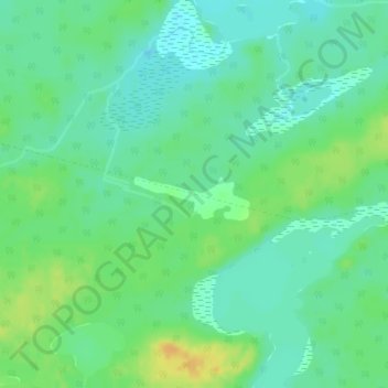
Name: Grant topographic map, elevation, terrain.
Average elevation: 1,010 ft
Minimum elevation: 974 ft
Maximum elevation: 1,066 ft
Other topographic maps
Click on a map to view its topography, its elevation and its terrain.
Kabinakagami River
Canada > Ontario > Cochrane District > Unorganized North Cochrane
Average elevation: 820 ft
Snare Lake
Canada > Ontario > Cochrane District > Unorganized North Cochrane
Average elevation: 984 ft
Ptarmigan Lake
Canada > Ontario > Cochrane District > Unorganized North Cochrane
Average elevation: 738 ft
Lady Lake
Canada > Ontario > Cochrane District > Unorganized North Cochrane
Average elevation: 1,017 ft
Joseph Lake
Canada > Ontario > Cochrane District > Unorganized North Cochrane
Average elevation: 889 ft
Moose Factory Island
Canada > Ontario > Cochrane District > Unorganized North Cochrane
Average elevation: 13 ft
Wadsworth Lake
Canada > Ontario > Cochrane District > Unorganized North Cochrane
Average elevation: 1,060 ft
Ghost River
Canada > Ontario > Cochrane District > Unorganized North Cochrane
Average elevation: 942 ft
Teal Creek
Canada > Ontario > Cochrane District > Unorganized North Cochrane
Average elevation: 666 ft
Ghost Lake;Pearce Creek
Canada > Ontario > Cochrane District > Unorganized North Cochrane
Average elevation: 699 ft
Sheen Lake
Canada > Ontario > Cochrane District > Unorganized North Cochrane
Average elevation: 925 ft
Moose Factory Island
Canada > Ontario > Cochrane District > Unorganized North Cochrane
Average elevation: 13 ft
Big Cedar Creek
Canada > Ontario > Cochrane District > Unorganized North Cochrane
Average elevation: 161 ft