
Bennett topographic map
Click on the map to display elevation.
About this map
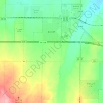
Name: Bennett topographic map, elevation, terrain.
Location: Bennett, Adams County, Colorado, 80102, United States (39.69468 -104.48012 39.76717 -104.37794)
Average elevation: 5,551 ft
Minimum elevation: 5,387 ft
Maximum elevation: 5,833 ft
Adams County trails, hiking, mountain biking, running and outdoor activities
Other topographic maps
Click on a map to view its topography, its elevation and its terrain.
Westminster
United States > Colorado > Adams County > Westminster > Westminster
Average elevation: 5,446 ft