Carson topographic map
Interactive map
Click on the map to display elevation.
About this map
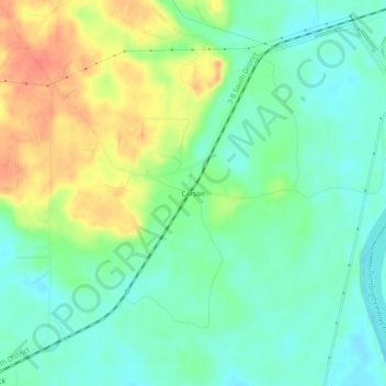
Name: Carson topographic map, elevation, terrain.
Location: Carson, Washington County, Alabama, 36548, United States (31.45239 -87.96139 31.49239 -87.92139)
Average elevation: 59 ft
Minimum elevation: 0 ft
Maximum elevation: 154 ft
Other topographic maps
Click on a map to view its topography, its elevation and its terrain.
Walley
United States > Alabama > Washington County
Walley, Washington County, Alabama, United States
Average elevation: 240 ft
Chatom
United States > Alabama > Washington County
Chatom, Washington County, Alabama, 36518, United States
Average elevation: 157 ft
Deer Park
United States > Alabama > Washington County
Deer Park, Washington County, Alabama, United States
Average elevation: 157 ft
Tibbie
United States > Alabama > Washington County > Tibbie
Tibbie, Washington County, Alabama, 36583, United States
Average elevation: 180 ft
McIntosh
United States > Alabama > Washington County > McIntosh
McIntosh, Washington County, Alabama, United States
Average elevation: 43 ft