Geolocate

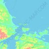
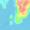
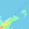
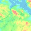
Anchor Point topographic map

Click on the map to display elevation.

About this map

Name: Anchor Point topographic map, elevation, terrain.

Location: Anchor Point, Newfoundland, Newfoundland and Labrador, Canada (51.22582 -56.81475 51.25244 -56.77096)

Average elevation: 16 ft

Minimum elevation: -3 ft

Maximum elevation: 66 ft

Other topographic maps

Click on a map to view its topography, its elevation and its terrain.
Bell Island

Canada > Newfoundland and Labrador

Average elevation: 30 ft

Labrador

Canada > Newfoundland and Labrador

Average elevation: 2,211 ft

Englee

Canada > Newfoundland and Labrador > Englee

Average elevation: 112 ft

Mount Caubvick

Canada > Newfoundland and Labrador

Average elevation: 4,173 ft

Highway 220

Canada > Newfoundland and Labrador

Average elevation: 26 ft

Whitbourne

Canada > Newfoundland and Labrador > Whitbourne

Average elevation: 230 ft

Grosse Point

Canada > Newfoundland and Labrador

Average elevation: 82 ft
Ragged Point

Canada > Newfoundland and Labrador

Average elevation: 20 ft

Bridgeport

Canada > Newfoundland and Labrador

Average elevation: 72 ft

Monroe

Canada > Newfoundland and Labrador

Average elevation: 135 ft

Smokey

Canada > Newfoundland and Labrador > Smokey

Average elevation: 46 ft

Tims Hill

Canada > Newfoundland and Labrador

Average elevation: 413 ft

Gear up for your next adventure:

🎒Trekking Poles - Sturdy poles for balance and stability on rough terrain
🛰️Satellite Messengers - Emergency SOS and two-way messaging for off-grid adventures
🥾Men's Hiking Boots - Durable, waterproof footwear for rugged terrain and steep inclines
📻Weather Alert Radios - Stay informed of storm risks while off-the-grid
🧣Merino Neck Gaiters - Multi-functional headwear for wind and sun protection

As an Amazon Associate, this site earns from qualifying purchases at no extra cost to you.