Geolocate

Santaquin topographic map

Click on the map to display elevation.

About this map

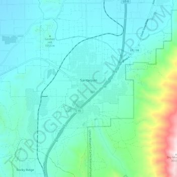
Name: Santaquin topographic map, elevation, terrain.

Location: Santaquin, Utah County, Utah, 84655, United States (39.93830 -111.84303 40.00468 -111.73413)

Average elevation: 5,394 ft

Minimum elevation: 4,534 ft

Maximum elevation: 9,820 ft

Utah County trails, hiking, mountain biking, running and outdoor activities

Other topographic maps

Click on a map to view its topography, its elevation and its terrain.

Nutty Putty Cave

United States > Utah > Utah County

Average elevation: 5,075 ft

Spanish Fork Peak

United States > Utah > Utah County

Average elevation: 8,924 ft

Birdseye

United States > Utah > Utah County

Average elevation: 5,840 ft

Bald Mountain Overlook

United States > Utah > Utah County

Average elevation: 8,373 ft

Mount Timpanogos

United States > Utah > Utah County

Average elevation: 10,299 ft

Curtis

United States > Utah > Utah County > Orem

Average elevation: 4,701 ft

Lone Peak

United States > Utah > Utah County

Average elevation: 9,885 ft

Caryhurst

United States > Utah > Utah County > Provo

Average elevation: 5,128 ft

Mount Timpanogos

United States > Utah > Utah County

Average elevation: 10,299 ft

Townsend

United States > Utah > Utah County > Genola

Average elevation: 4,718 ft

Pleasant View

United States > Utah > Utah County > Provo

Average elevation: 4,744 ft

Lone Peak

United States > Utah > Utah County

Average elevation: 9,885 ft

Gear up for your next adventure:

🧢Sun Protection Hats - Wide-brimmed and UPF-rated hats for high-altitude sun safety
🛰️Satellite Messengers - Emergency SOS and two-way messaging for off-grid adventures
🪓Survival Multi‑Tool - Versatile tool for camp and trail tasks
🚗GPS Dash Cams - Record your scenic drives through mountain passes and canyons
🦺Reflective Outdoor Gear - Safety gear for low‑light conditions

As an Amazon Associate, this site earns from qualifying purchases at no extra cost to you.