
Gallia County topographic map
Interactive map
Click on the map to display elevation.
About this map
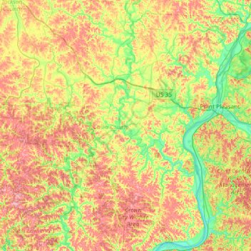
Name: Gallia County topographic map, elevation, terrain.
Location: Gallia County, Ohio, United States (38.58282 -82.58280 39.03521 -82.09548)
Average elevation: 741 ft
Minimum elevation: 518 ft
Maximum elevation: 1,033 ft
Ohio trails, hiking, mountain biking, running and outdoor activities
Other topographic maps
Click on a map to view its topography, its elevation and its terrain.
Campbell Hill
United States > Ohio > Logan County > Bellefontaine
Campbell Hill is, at 1,549.09 feet (472.16 m), the highest point in elevation in the U.S. state of Ohio. Campbell Hill is located within the city of Bellefontaine, 2 miles (3.2 km) northeast of downtown.
Average elevation: 1,457 ft
Pater Lake Wildlife Area
United States > Ohio > Butler County > Reily Township
Average elevation: 781 ft
Hocking Hills State Park Mountain Bike Trail Head
United States > Ohio > Hocking County
Average elevation: 1,004 ft
Buena Vista Heights
United States > Ohio > Jefferson County > Steubenville
Average elevation: 1,073 ft
Cleveland
United States > Ohio > Cuyahoga County > Cleveland
The land rises quickly from the lake shore elevation of 569 feet. Public Square, less than one mile (1.6 km) inland, sits at an elevation of 650 feet (198 m), and Hopkins Airport, 5 miles (8 km) inland from the lake, is at an elevation of 791 feet (241 m).
Average elevation: 725 ft
Columbus
United States > Ohio > Franklin County > Columbus
The confluence of the Scioto and Olentangy rivers is just north-west of Downtown Columbus. Several smaller tributaries course through the Columbus metropolitan area, including Alum Creek, Big Walnut Creek, and Darby Creek. Columbus is considered to have relatively flat topography thanks to a large glacier that…
Average elevation: 837 ft
Ashland County Fairgrounds
United States > Ohio > Ashland County > Ashland
Average elevation: 1,247 ft
South Clippinger
United States > Ohio > Hamilton County > The Village of Indian Hill
Average elevation: 827 ft
Highlandtown Lake Dam
United States > Ohio > Columbiana County > Highlandtown
Average elevation: 1,129 ft
Cincinnati
United States > Ohio > Hamilton County
Cincinnati has several standard modes of transportation including sidewalks, roads, public transit, bicycle paths and airports. The city's hills preclude the regular street grid common to many cities built up in the 19th century, and outside of the downtown basin, regular street grids are rare except for in…
Average elevation: 738 ft
Tom S Cooperrider-Kent Bog State Nature Preserve
United States > Ohio > Portage County
Average elevation: 1,099 ft