
San Carlos Park topographic map
Interactive map
Click on the map to display elevation.
About this map
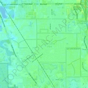
Name: San Carlos Park topographic map, elevation, terrain.
Location: San Carlos Park, Lee County, Florida, 33967, United States (26.45279 -81.84624 26.49276 -81.79717)
Average elevation: 23 ft
Minimum elevation: 3 ft
Maximum elevation: 39 ft
Lee County trails, hiking, mountain biking, running and outdoor activities
Other topographic maps
Click on a map to view its topography, its elevation and its terrain.
Cape Coral
United States > Florida > Lee County
Cape Coral is characterized by its predominantly flat and low-lying terrain, with an average elevation of around 13 feet (4 meters) above sea level. The area's topography features a network of canals, with over 400 miles of navigable waterways, making it one of the most waterway-dense cities globally. The…
Average elevation: 13 ft
Fort Myers
United States > Florida > Lee County
Fort Myers, located in Lee County, Florida, features a predominantly flat topography characterized by low elevations, averaging around 10 to 16 feet (approximately 3 to 5 meters) above sea level. The area is primarily composed of coastal plains, which contribute to its lush, subtropical vegetation and…
Average elevation: 16 ft
Habitat for Humanity Housing
United States > Florida > Lee County > North Fort Myers
Average elevation: 10 ft
Rivers Edge Mobile Home Park
United States > Florida > Lee County > North Fort Myers
Average elevation: 7 ft
Saint James Mobile Home Park
United States > Florida > Lee County > Saint James City
Average elevation: 3 ft
Sunset North Condominiums
United States > Florida > Lee County > North Fort Myers
Average elevation: 7 ft
Caloosa Mobile Home Village
United States > Florida > Lee County > North Fort Myers
Average elevation: 7 ft
Council
United States > Florida > Lee County > Bonita Springs > Pelican Landing
Average elevation: 20 ft
Bonita National Golf & Country Club
United States > Florida > Lee County > Bonita Springs
Average elevation: 16 ft
Highland Woods Golf & Country Club
United States > Florida > Lee County > Bonita Springs
Average elevation: 16 ft
Bonita National Golf & Country Club
United States > Florida > Lee County > Bonita Springs
Average elevation: 16 ft
Spring Creek Village
United States > Florida > Lee County > Bonita Springs > Pelican Landing
Average elevation: 13 ft
Mirasol at Coconut Point
United States > Florida > Lee County > Mirasol at Coconut Point
Average elevation: 20 ft
Spring Creek Estates
United States > Florida > Lee County > Bonita Springs > Spring Creek Estates
Average elevation: 10 ft