
Atherton topographic map
Interactive map
Click on the map to display elevation.
About this map
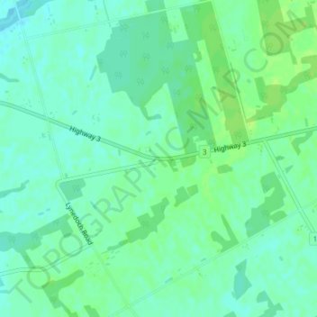
Name: Atherton topographic map, elevation, terrain.
Average elevation: 781 ft
Minimum elevation: 761 ft
Maximum elevation: 797 ft
Other topographic maps
Click on a map to view its topography, its elevation and its terrain.
Lac Seul
Canada > Ontario > Kenora District
Lac Seul is a large, crescent shaped reservoir in Kenora District, northwestern Ontario, Canada. It is approximately 241 km (150 mi) long. It has a maximum (regulated) depth of 47.2 m, with a surface elevation of 357 m above sea level. Its level is raised in the summer and then drawn down in the winter months…
Average elevation: 1,273 ft
Lower Beverley Lake
Canada > Ontario > Leeds and Grenville Counties > Rideau Lakes > Delta
Average elevation: 371 ft
Slate Islands
Canada > Ontario > Kenora District > Unorganized Kenora District
Average elevation: 1,056 ft
Golden Lake
Canada > Ontario > Renfrew County > North Algona Wilberforce > Golden Lake
Average elevation: 640 ft
Peel Region
The region's climate are influenced by various air masses and weather systems from other locations, proximity to Lake Ontario, topography and elevation (e.g. Niagara Escarpment, and Oak Ridges Moraine), and urban and rural land uses. The air masses and weather systems are the major factors in influencing the…
Average elevation: 869 ft
St. Catharines
Canada > Ontario > Niagara Region
The most defining transportation icon of St. Catharines is the Welland Canal, a ship canal that runs 43.4 kilometres (27.0 mi), passing through the city. Four of its locks are within city boundaries. The canal allows shipping vessels to traverse the 99.5-metre (326.5 ft) drop in altitude from Lake Erie to Lake…
Average elevation: 338 ft
Granitehill Lake
Canada > Ontario > Algoma District > Unorganized North Algoma
Average elevation: 1,247 ft
South-West Oxford
Canada > Ontario > Oxford County
In its wilderness state, the former Dereham township had thousands of acres of swamp and marsh land which limited its use for agriculture. Several large drainage projects brought great improvement and remain as essential parts of the township's farmland infrastructure. The township topography still has several…
Average elevation: 922 ft
Lake Ontario
Lake Ontario is the easternmost of the Great Lakes and the smallest in surface area (7,340 sq mi, 18,960 km2), although it exceeds Lake Erie in volume (393 cu mi, 1,639 km3). It is the 13th largest lake in the world. When its islands are included, the lake's shoreline is 712 miles (1,146 km) long. As the last…
Average elevation: 702 ft
Sesekinika Lake
Canada > Ontario > Timiskaming District > Unorganized West Timiskaming
Average elevation: 1,047 ft
Ellery Lake
Canada > Ontario > Cochrane District > Unorganized North Cochrane
Average elevation: 1,148 ft
Echo Lake
Canada > Ontario > Timiskaming District > Unorganized West Timiskaming
Average elevation: 1,112 ft
Gibi Lake
Canada > Ontario > Kenora District > Sioux Narrows-Nestor Falls Township
Average elevation: 1,224 ft
Galbraith Lake
Canada > Ontario > Kenora District > Unorganized Kenora District
Average elevation: 1,493 ft
Opeongo Lake Dam
Canada > Ontario > Nipissing District > Unorganized South Nipissing
Average elevation: 1,375 ft
Calm Lake
Canada > Ontario > Rainy River District > Unorganized Rainy River
Average elevation: 1,283 ft
Negeek Lake
Canada > Ontario > Renfrew County > Madawaska Valley > Combermere
Average elevation: 1,004 ft
Kapuskasing
Canada > Ontario > Cochrane District
Kapuskasing lies in the heart of the Great Clay Belt. The topography of the region is very flat, dotted with numerous small lakes and muskeg bogs. Also in the heart of Canada's boreal forest, the region is drained by rivers running north to James Bay. The district is heavily forested, mostly by thick stands of…
Average elevation: 745 ft
Hubbard Creek
Canada > Ontario > Sudbury District > Unorganized North Sudbury
Average elevation: 1,499 ft
Loveland Lake
Canada > Ontario > Kenora District > Unorganized Kenora District
Average elevation: 1,398 ft
Kellow Lake
Canada > Ontario > Thunder Bay District > Unorganized Thunder Bay District
Average elevation: 965 ft
Peterborough
Peterborough's topography is largely defined by land formations created by the receding Wisconsian glaciers 10,000–15,000 years ago. The South End and Downtown portions of the city sit on what was the bottom of the glacial Lake Peterborough—part of a glacial spillway created when glacial meltwaters from…
Average elevation: 761 ft
Nungesser Lake
Canada > Ontario > Kenora District > Unorganized Kenora District
Average elevation: 1,352 ft
Rowan Lake
Canada > Ontario > Nipissing District > Unorganized South Nipissing
Average elevation: 922 ft
Thousand Islands National Park
Canada > Ontario > Prince Edward County > Frontenac Islands
Average elevation: 354 ft
Edison Lake
Canada > Ontario > Kenora District > Unorganized Kenora District
Average elevation: 1,263 ft
Demott Lake
Canada > Ontario > Sudbury District > Unorganized North Sudbury
Average elevation: 1,293 ft