
Elmhurst topographic map
Interactive map
Click on the map to display elevation.
Elmhurst
Due to local topography, the town has had a tendency to flood in the past after large rainfalls; the city is currently undertaking a large effort to mitigate future flooding.
About this map
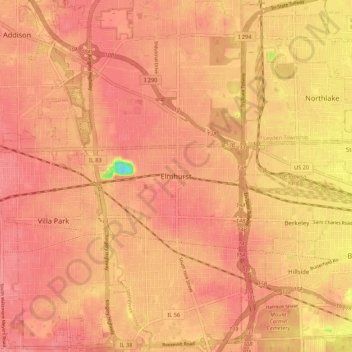
Name: Elmhurst topographic map, elevation, terrain.
Location: Elmhurst, DuPage County, Illinois, 60126, United States (41.85947 -87.98034 41.93947 -87.90034)
Average elevation: 679 ft
Minimum elevation: 489 ft
Maximum elevation: 735 ft
DuPage County trails, hiking, mountain biking, running and outdoor activities
Other topographic maps
Click on a map to view its topography, its elevation and its terrain.
Glendale Heights
United States > Illinois > DuPage County
The town was originally named Glendale as it was between Glen Ellyn and Bloomingdale, but after a conflict arose with the small town of Glendale in Southern Illinois, the city decided in March 1960 to add the term Heights, in reference to its different topographies, a difference of about 100 feet (30 m)…
Average elevation: 768 ft