
Shalimar topographic map
Interactive map
Click on the map to display elevation.
About this map
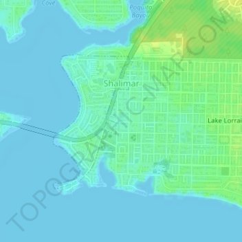
Name: Shalimar topographic map, elevation, terrain.
Location: Shalimar, Okaloosa County, Florida, United States (30.43396 -86.58798 30.44903 -86.57763)
Average elevation: 13 ft
Minimum elevation: -3 ft
Maximum elevation: 52 ft
Okaloosa County trails, hiking, mountain biking, running and outdoor activities
Other topographic maps
Click on a map to view its topography, its elevation and its terrain.