
Logan Village topographic map
Click on the map to display elevation.
About this map
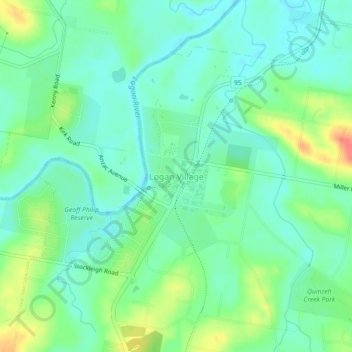
Name: Logan Village topographic map, elevation, terrain.
Location: Logan Village, Greater Brisbane, Queensland, Australia (-27.78755 153.08701 -27.74755 153.12701)
Average elevation: 72 ft
Minimum elevation: 13 ft
Maximum elevation: 200 ft
Other topographic maps
Click on a map to view its topography, its elevation and its terrain.
City of Brisbane
Brisbane's topography is characterized by a series of hills and ranges that define its landscape. The city is situated on a low-lying floodplain, with the Brisbane River meandering through its heart, creating a winding course with many steep curves from the southwest to its mouth at Moreton Bay in the east.…
Average elevation: 233 ft
Mount Coot-tha
Australia > Queensland > City of Brisbane
It is often claimed that Mount Coot-tha is the "highest point in Brisbane", but, as the elevations above show, the peak known as Mount Coot-tha is not even the highest peak of the mountain as a whole with both Constitution Hill and The Summit being higher. However, Mount Coot-tha has a lookout with unobscured…
Average elevation: 289 ft
Sunshine Coast Regional
The Sunshine Coast Regional area in Queensland, Australia, features a diverse topography that ranges from coastal plains to rugged hinterlands. Along the coastline, the terrain is predominantly flat, with average elevations around 20 meters (66 feet) above sea level. Inland, the landscape transitions to…
Average elevation: 184 ft
Mornington Island
The general topography of the island, which lies on the eastern (Queensland) side of the Gulf of Carpentaria, is flat with the maximum elevation of 150 metres (490 ft). The island is fringed by mangrove forests and contains 10 estuaries, all in near pristine condition.
Average elevation: 10 ft
Stanthorpe
Owing to its elevation, Stanthorpe features a subtropical highland climate (Cfb). At an altitude of 811 metres (2,661 ft), Stanthorpe holds the record for the lowest temperature recorded in Queensland at −10.6 °C (12.9 °F) on 23 June 1961.
Average elevation: 2,726 ft
Brisbane River
The RAAF also perform a practice session in the days preceding the event, serving as an opportunity to both practice beforehand and also promote Riverfire. One of the most popular RAAF aircraft to perform at Riverfire was the F-111 which was known for performing a 'dump-and-burn' above the city. The final…
Average elevation: 771 ft
Bribie Island
Australia > Queensland > Brisbane
Bribie Island, located in Queensland, Australia, is a low-lying, elongated landmass stretching approximately 34 kilometers (21 miles) in length and up to 8 kilometers (5 miles) at its widest point. Composed predominantly of coastal sand plains, the island features two large, low-lying dunes extending…
Average elevation: 20 ft
Highfields
Along with Meringandan, the climate is oceanic (Köppen: Cfb) due to elevation, usually located further south of Australia.
Average elevation: 1,932 ft
Roma
Roma experiences a humid subtropical climate (Köppen: Cfa, Trewartha: Cfal); with hot summers with moderate rains; warm to hot, relatively dry springs and autumns; and mild, dry winters. Its location on the far south of the Carnarvon Range at an elevation of 299 metres above sea level means that it is cooler…
Average elevation: 1,033 ft