Geolocate

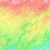
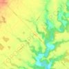
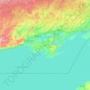
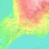
Lambton County topographic map

Click on the map to display elevation.

About this map

Name: Lambton County topographic map, elevation, terrain.

Location: Lambton County, Southwestern Ontario, Ontario, Canada (42.39763 -82.80349 43.31963 -81.74315)

Average elevation: 656 ft

Minimum elevation: 561 ft

Maximum elevation: 876 ft

Other topographic maps

Click on a map to view its topography, its elevation and its terrain.
Toronto

Canada > Ontario > Toronto

Despite its deep ravines, Toronto is not remarkably hilly, but its elevation does increase steadily away from the lake. Elevation differences range from 76.5 metres (251 ft) above sea level at the Lake Ontario shore to 209 m (686 ft) ASL near the York University grounds in the city's north end at the…

Average elevation: 371 ft
Peterborough

Canada > Ontario > Peterborough

Peterborough's topography is largely defined by land formations created by the receding Wisconsian glaciers 10,000–15,000 years ago. The South End and Downtown portions of the City sit on what was the bottom of the glacial Lake Peterborough—part of a glacial spillway created when glacial meltwaters from…

Average elevation: 771 ft
London

Canada > Ontario > London > London

London has a humid continental climate (Köppen Dfb), though due to its downwind location relative to Lake Huron and elevation changes across the city, it is virtually on the Dfa/Dfb (hot summer) boundary favouring the former climate zone to the southwest of the confluence of the South and North Thames Rivers,…

Average elevation: 879 ft
Kingston

Canada > Ontario > Kingston

Average elevation: 308 ft

Guelph

Canada > Ontario > Guelph

This region of Ontario has cold winters and warm, humid summers, falling into the Köppen climate classification Dfb zone, with moderately high rainfall and snowfall. It is generally a couple of degrees cooler than lower elevation regions on the Great Lakes shorelines, especially so in winter, the exception…

Average elevation: 1,129 ft
Hamilton

Canada > Ontario > Hamilton

Average elevation: 594 ft

Windsor

Canada > Ontario > Windsor

Average elevation: 607 ft

Niagara Escarpment

Canada > Ontario > Hamilton

Average elevation: 531 ft

Trenton

Canada > Ontario > Quinte West

Average elevation: 292 ft

Spadina Park

Canada > Ontario > Toronto

Average elevation: 449 ft

Iona

Canada > Ontario > Elgin County > Dutton/Dunwich

Average elevation: 696 ft

Haliburton

Canada > Ontario

Average elevation: 1,175 ft

Perth

Canada > Ontario

Average elevation: 1,027 ft

Parry Sound

Canada > Ontario

Average elevation: 771 ft

Dorset

Canada > Ontario > Muskoka District

Average elevation: 1,158 ft

Ayr

Canada > Ontario > Region of Waterloo > North Dumfries

Average elevation: 978 ft

Sioux Lookout

Canada > Ontario > Kenora District

Average elevation: 1,191 ft

Almonte

Canada > Ontario > Lanark County > Mississippi Mills

Average elevation: 449 ft

Lake Belwood

Canada > Ontario > Centre Wellington

Average elevation: 1,391 ft

Binbrook

Canada > Ontario > Hamilton > Binbrook

Average elevation: 692 ft

West Flamborough

Canada > Ontario > Hamilton

Average elevation: 745 ft

Millbrook

Canada > Ontario > Peterborough County > Cavan-Monaghan

Peterborough's topography is largely defined by land formations created by the receding Wisconsian glaciers 10,000–15,000 years ago. The South End and Downtown portions of the city sit on what was the bottom of the glacial Lake Peterborough—part of a glacial spillway created when glacial meltwaters from…

Average elevation: 820 ft
Milton

Canada > Ontario > Halton Region > Milton

Average elevation: 712 ft

Scotland

Canada > Ontario > Brant County

Average elevation: 823 ft

Ipperwash Beach

Canada > Ontario > Lambton County > Lambton Shores

Average elevation: 594 ft

Elmira

Canada > Ontario > Region of Waterloo > Woolwich

Average elevation: 1,188 ft

Sweaburg

Canada > Ontario > Oxford County > South-West Oxford

Average elevation: 1,040 ft

Casselman

Canada > Ontario > Prescott and Russell Counties

Average elevation: 210 ft

Kenora

Canada > Ontario

Average elevation: 597 ft

Prince Edward

Canada > Ontario

Average elevation: 387 ft

Lambton

Canada > Ontario

Average elevation: 617 ft

Essex

Canada > Ontario

Average elevation: 633 ft

Bruce Peninsula

Canada > Ontario > Grey County > Georgian Bluffs

Average elevation: 787 ft

Lac Seul

Canada > Ontario

Average elevation: 1,198 ft

Harlem Shoal

Canada > Ontario

Average elevation: 574 ft

St. Johns

Canada > Ontario

Average elevation: 673 ft

Quetico Provincial Park

Canada > Ontario

Average elevation: 1,417 ft

Ohsweken

Canada > Ontario

Average elevation: 682 ft

Shadow Lake

Canada > Ontario > Kawartha Lakes

Average elevation: 873 ft

Loon Lake

Canada > Ontario > Kearney

Average elevation: 1,309 ft

Pinehurst Lake

Canada > Ontario

Average elevation: 968 ft

Docker Lake

Canada > Ontario

Average elevation: 1,237 ft

Oneida Nation of the Thames

Canada > Ontario

Average elevation: 735 ft

Bigwin Island

Canada > Ontario

Average elevation: 1,076 ft

Upper Pergeon Lake

Canada > Ontario

Average elevation: 705 ft

Niagara Escarpment

Canada > Ontario

Average elevation: 981 ft

York River

Canada > Ontario

Average elevation: 1,302 ft

Muskrat Lake

Canada > Ontario > Renfrew County > Cobden

Average elevation: 479 ft

Kawartha Lakes (city)

Canada > Ontario

Average elevation: 899 ft

Pelee Island

Canada > Ontario

Average elevation: 568 ft

Quinte West (city)

Canada > Ontario

Average elevation: 525 ft

London

Canada > Ontario

London has a humid continental climate (Köppen Dfb), though due to its downwind location relative to Lake Huron and elevation changes across the city, it is virtually on the Dfa/Dfb (hot summer) boundary favouring the former climate zone to the southwest of the confluence of the South and North Thames Rivers,…

Average elevation: 883 ft

Lambton

Canada > Ontario

Average elevation: 627 ft

Algoma District

Canada > Ontario

Average elevation: 1,181 ft

London (city)

Canada > Ontario

Average elevation: 784 ft

Belleville

Canada > Ontario > Belleville

Average elevation: 351 ft

Cambridge

Canada > Ontario > Cambridge

Average elevation: 968 ft

Minden

Canada > Ontario > Haliburton County > Minden Hills

Average elevation: 1,050 ft

Port Perry

Canada > Ontario > Durham Region > Scugog

Average elevation: 863 ft

Dundas

Canada > Ontario > Hamilton > Dundas

Dundas /ˈdʌnˌdæs/ is a community and former town in Hamilton, Ontario, Canada. It is nicknamed the Valley Town because of its topographical location at the bottom of the Niagara Escarpment on the western edge of Lake Ontario. The population has been stable for decades at about twenty thousand, largely…

Average elevation: 561 ft
Hinder Area

Canada > Ontario > Toronto

Average elevation: 591 ft

Ottawa

Canada > Ontario > Ottawa > Ottawa

Average elevation: 325 ft

Port Elgin

Canada > Ontario > Bruce County

Average elevation: 653 ft

Morningside Park

Canada > Ontario > Toronto

Average elevation: 436 ft

Woodstock

Canada > Ontario > Woodstock

Average elevation: 1,004 ft

Schomberg

Canada > Ontario > York Region > King

Average elevation: 797 ft

Sagamok

Canada > Ontario > Algoma District

Average elevation: 689 ft

Arden

Canada > Ontario > Frontenac County > Central Frontenac

Average elevation: 656 ft

Turtle Island

Canada > Ontario > Georgian Bay Township

Average elevation: 636 ft

Pikangikum

Canada > Ontario > Kenora District

Average elevation: 1,093 ft

Kinburn

Canada > Ontario > Ottawa

Average elevation: 331 ft

Caledon

Canada > Ontario > Peel Region

Average elevation: 1,020 ft

Acton

Canada > Ontario > Halton Region

Average elevation: 1,188 ft

Turkey Point

Canada > Ontario > Norfolk County

Average elevation: 614 ft

Skead

Canada > Ontario > Sudbury District > Greater Sudbury

Average elevation: 968 ft

Janetville

Canada > Ontario > Kawartha Lakes

Average elevation: 906 ft

Brantford

Canada > Ontario > Brantford

Average elevation: 781 ft

Brockville

Canada > Ontario > Brockville

Average elevation: 338 ft

Cornwall

Canada > Ontario > Cornwall

Average elevation: 220 ft

Orillia

Canada > Ontario > Orillia

Average elevation: 774 ft

Quinte West

Canada > Ontario > Quinte West

Average elevation: 361 ft

Stratford

Canada > Ontario > Stratford

Average elevation: 1,168 ft

French River

Canada > Ontario > Sudbury District

Average elevation: 682 ft

Kawartha Lakes

Canada > Ontario > Kawartha Lakes

Average elevation: 883 ft

Chalk River

Canada > Ontario > Laurentian Hills

Average elevation: 659 ft

Gear up for your next adventure:

🛏️Cold Weather Sleeping Bag - Warm sleeping bag for cold conditions
🛠️Outdoor Gear Repair Kit - Essential tools to fix gear on the trail
🔭Telescopic Hiking Pole - Adjustable pole for hiking stability
🧭Map Reading Tools - Tools and kits for map navigation
🥾Women's Hiking Boots - Top-rated trail boots with ankle support and superior grip

As an Amazon Associate, this site earns from qualifying purchases at no extra cost to you.