
Fillan topographic map
Interactive map
Click on the map to display elevation.
About this map
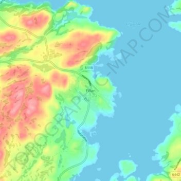
Name: Fillan topographic map, elevation, terrain.
Location: Fillan, Hitra, Tröndelag, 7240, Norwegen (63.58243 8.95582 63.62243 8.99582)
Average elevation: 95 ft
Minimum elevation: 0 ft
Maximum elevation: 341 ft
Other topographic maps
Click on a map to view its topography, its elevation and its terrain.
Brettingen fort
Norwegen > Tröndelag > Fevågaunet
Brettingen fort, Brettingsveien, Fevågaunet, Indre Fosen, Tröndelag, 7112, Norwegen
Average elevation: 98 ft
Kyrksæterøra
Kyrksæterøra, Heim, Tröndelag, 7200, Norwegen
Average elevation: 341 ft
Utvorden fort Sør
Norwegen > Tröndelag > Utvorda
Utvorden fort Sør, Utvordveien, Utvorda, Flatanger, Tröndelag, Norwegen
Average elevation: 131 ft