
Feldkirchen topographic map
Click on the map to display elevation.
About this map
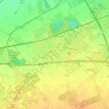
Name: Feldkirchen topographic map, elevation, terrain.
Location: Feldkirchen, Landkreis München, Bavaria, 85622, Germany (48.13266 11.70505 48.15770 11.75798)
Average elevation: 1,722 ft
Minimum elevation: 1,657 ft
Maximum elevation: 1,759 ft
Other topographic maps
Click on a map to view its topography, its elevation and its terrain.
Deisenhofen
Germany > Bavaria > Landkreis München > Oberhaching > Deisenhofen
Average elevation: 1,942 ft
Feldkirchen
Germany > Bavaria > Landkreis München > Feldkirchen > Feldkirchen
Average elevation: 1,719 ft