
Moncalieri topographic map
Click on the map to display elevation.
About this map
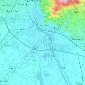
Name: Moncalieri topographic map, elevation, terrain.
Location: Moncalieri, Torino, Piedmont, 10024, Italy (44.92793 7.64802 45.03116 7.75711)
Average elevation: 846 ft
Minimum elevation: 702 ft
Maximum elevation: 2,316 ft
Other topographic maps
Click on a map to view its topography, its elevation and its terrain.