Geolocate

Limestone Gap topographic map

Click on the map to display elevation.
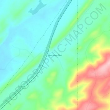
About this map

Name: Limestone Gap topographic map, elevation, terrain.

Location: Limestone Gap, Atoka County, Oklahoma, United States (34.58065 -95.99138 34.62065 -95.95138)

Average elevation: 761 ft

Minimum elevation: 604 ft

Maximum elevation: 1,158 ft

Atoka County trails, hiking, mountain biking, running and outdoor activities

Other topographic maps

Click on a map to view its topography, its elevation and its terrain.

Atoka

United States > Oklahoma > Atoka County

Average elevation: 604 ft

Caney

United States > Oklahoma > Atoka County

Average elevation: 554 ft

Tushka

United States > Oklahoma > Atoka County

Average elevation: 617 ft

Stringtown

United States > Oklahoma > Atoka County

Average elevation: 646 ft

Gear up for your next adventure:

🦺Reflective Outdoor Gear - Safety gear for low‑light conditions
🔭Telescopic Hiking Pole - Adjustable pole for hiking stability
📡Handheld GPS Device - Reliable handheld GPS for outdoor navigation
🥩Freeze-Dried Meals - Nutritious and lightweight food for remote expeditions
🎁Geography Themed Gifts - Unique gift ideas for map lovers and geography enthusiasts

As an Amazon Associate, this site earns from qualifying purchases at no extra cost to you.