Geolocate

Caney topographic map

Click on the map to display elevation.

About this map

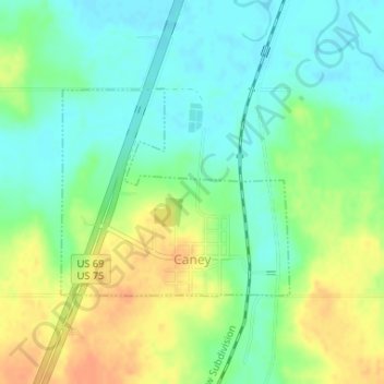
Name: Caney topographic map, elevation, terrain.

Location: Caney, Atoka County, Oklahoma, 74533, United States (34.22971 -96.22535 34.24432 -96.20585)

Average elevation: 554 ft

Minimum elevation: 502 ft

Maximum elevation: 623 ft

Atoka County trails, hiking, mountain biking, running and outdoor activities

Other topographic maps

Click on a map to view its topography, its elevation and its terrain.

Redden

United States > Oklahoma > Atoka County

Average elevation: 722 ft

Wesley

United States > Oklahoma > Atoka County

Average elevation: 820 ft

Limestone Gap

United States > Oklahoma > Atoka County

Average elevation: 761 ft

Hopewell

United States > Oklahoma > Atoka County

Average elevation: 719 ft

Farris

United States > Oklahoma > Atoka County

Average elevation: 535 ft

Chockie

United States > Oklahoma > Atoka County

Average elevation: 725 ft

Daisy

United States > Oklahoma > Atoka County

Average elevation: 823 ft

Wardville

United States > Oklahoma > Atoka County

Average elevation: 689 ft

Bentley

United States > Oklahoma > Atoka County

Average elevation: 541 ft

Gear up for your next adventure:

📻Weather Alert Radios - Stay informed of storm risks while off-the-grid
🧼Biodegradable Camping Soap - Eco‑friendly soap for outdoor hygiene
🧺Microfiber Travel Towels - Compact and fast-drying towels for trail use
📷Action Cameras - Rugged cameras to document your journeys across rugged terrain
🚪Portable Camp Chair - Foldable chair for comfort at camp

As an Amazon Associate, this site earns from qualifying purchases at no extra cost to you.